How Google's Ground Truth maps the world (pictures)
Google details its detailed program for reconciling multiple sources of data about the world into a unified, accurate mapping system.
Stephen Shankland
Stephen Shankland worked at CNET from 1998 to 2024 and wrote about processors, digital photography, AI, quantum computing, computer science, materials science, supercomputers, drones, browsers, 3D printing, USB, and new computing technology in general. He has a soft spot in his heart for standards groups and I/O interfaces. His first big scoop was about radioactive cat poop.
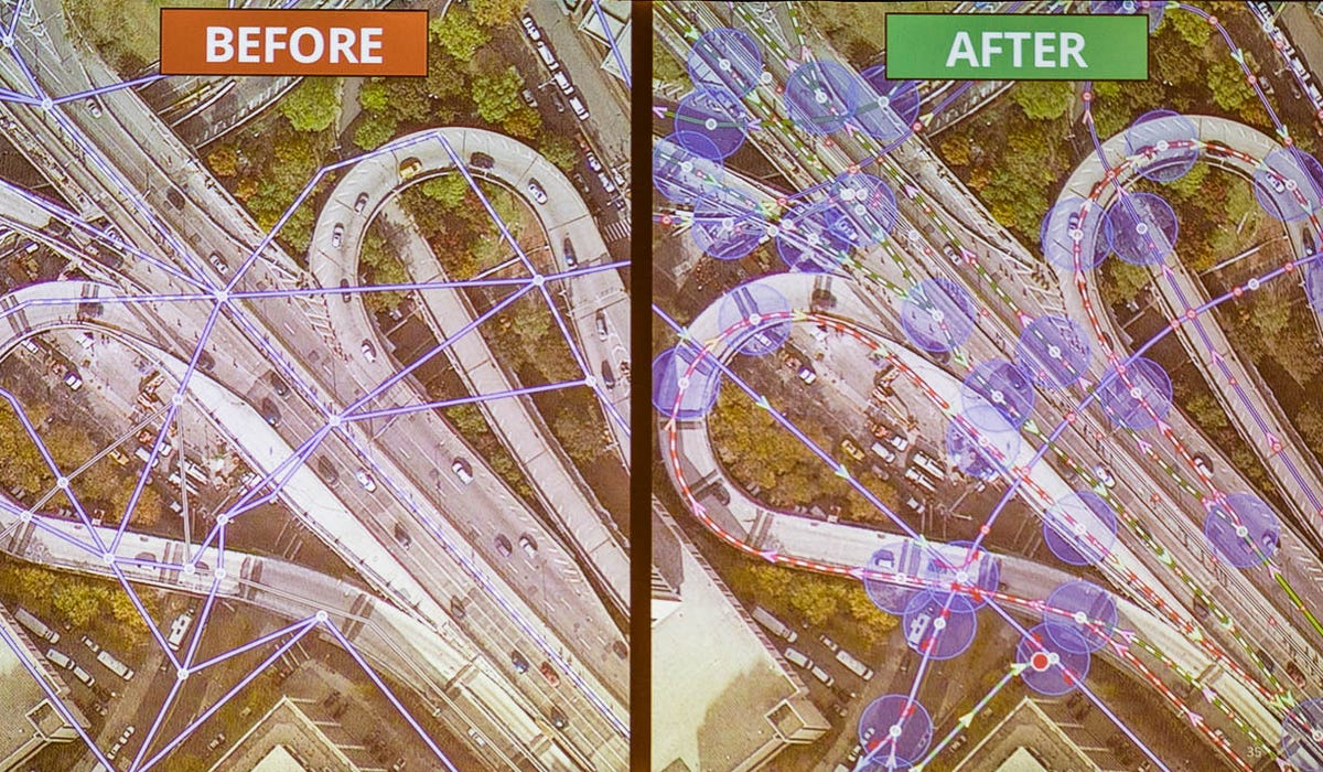
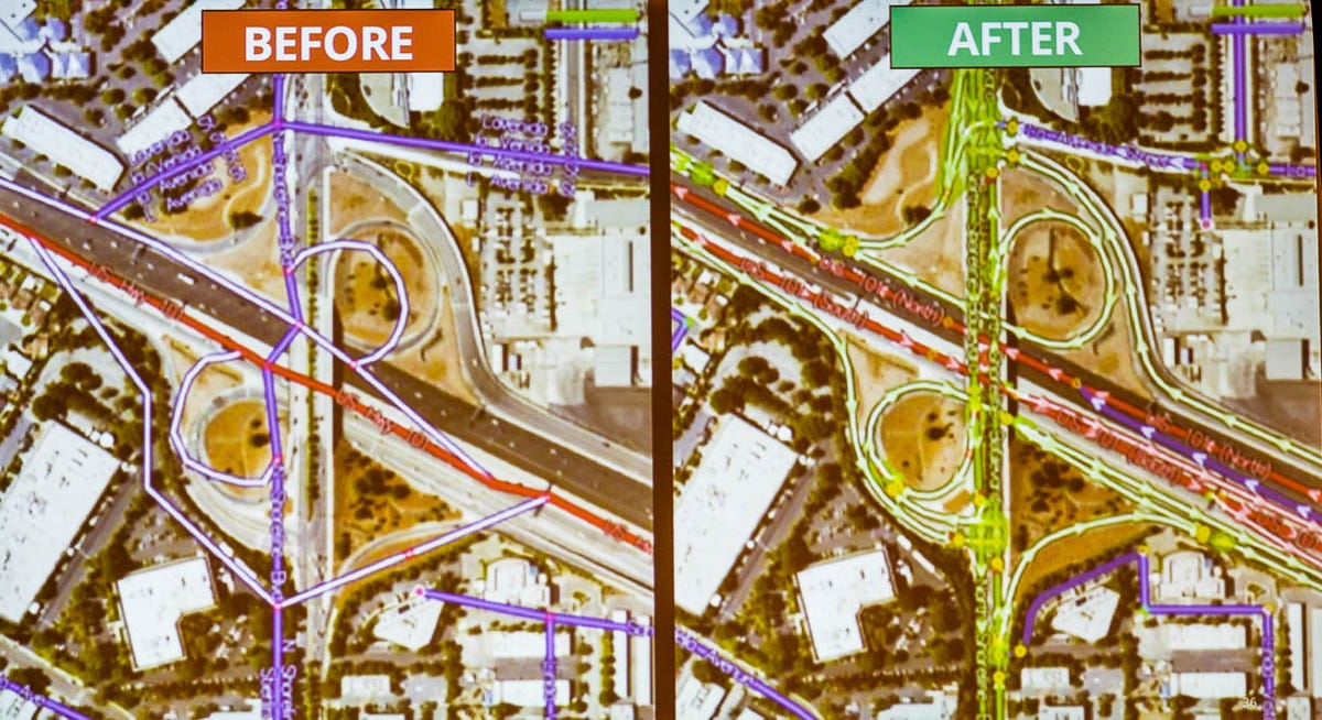
Google spends a lot of time correcting data it receives, through a project called Ground Truth. Here, the left side shows the original data from the U.S. census program. At right is Google's corrected version.
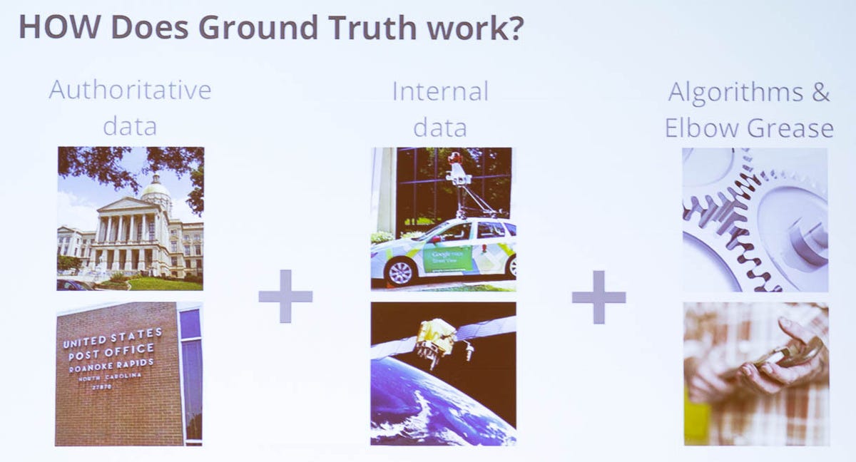
The essence of the Ground Truth project is marrying Google's real-world information with data sets from sources such as cities, census operations, and postal address databases. "You can conflate those two together and correct one with the other," says Michael Weiss-Malik, engineering director for Google's Ground Truth and Map Maker.
2 of 13 Stephen Shankland/CNET
Google's Ground Truth mapping
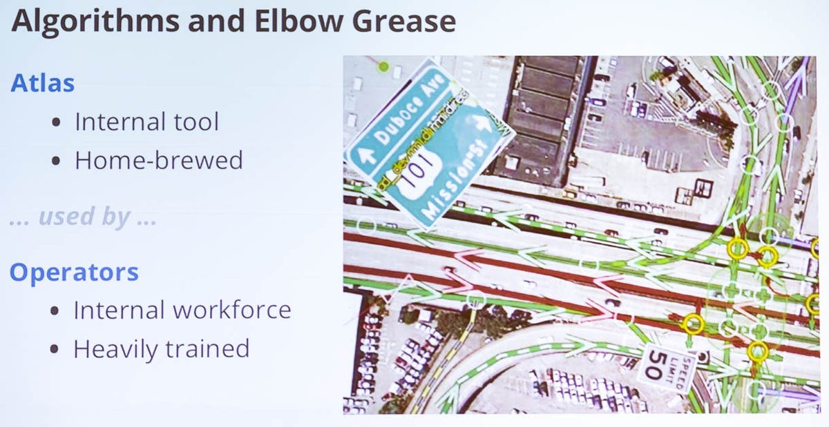
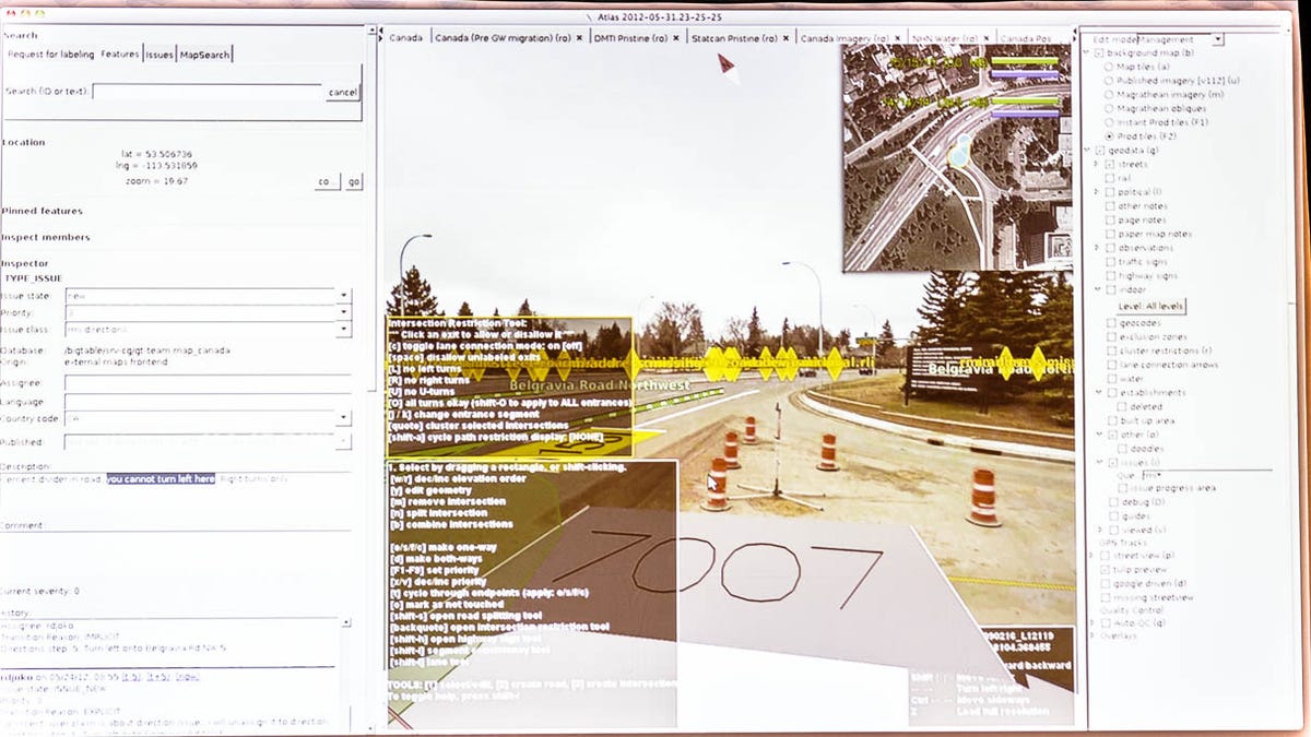
In Atlas, yellow routes indicate the direction a car is entering an intersection. Green routes are permissible, and red routes are prohibited.
3 of 13 Stephen Shankland/CNET
Google's Ground Truth mapping
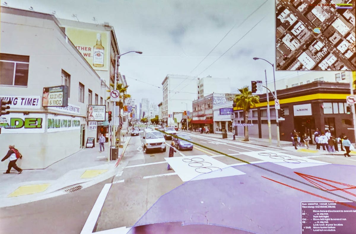
The Atlas tool lets Google Maps staffers hover over the map and see a fisheye-lens view of a particular point on a road. The bubble shows images taken with Street View.
4 of 13 Stephen Shankland/CNET
Google's Ground Truth mapping
With its Atlas tool, Google Maps staff can zoom into a Street View look at an intersection with Google's own graphical overlay of traffic restrictions.
5 of 13 Stephen Shankland/CNET
Google's Ground Truth mapping
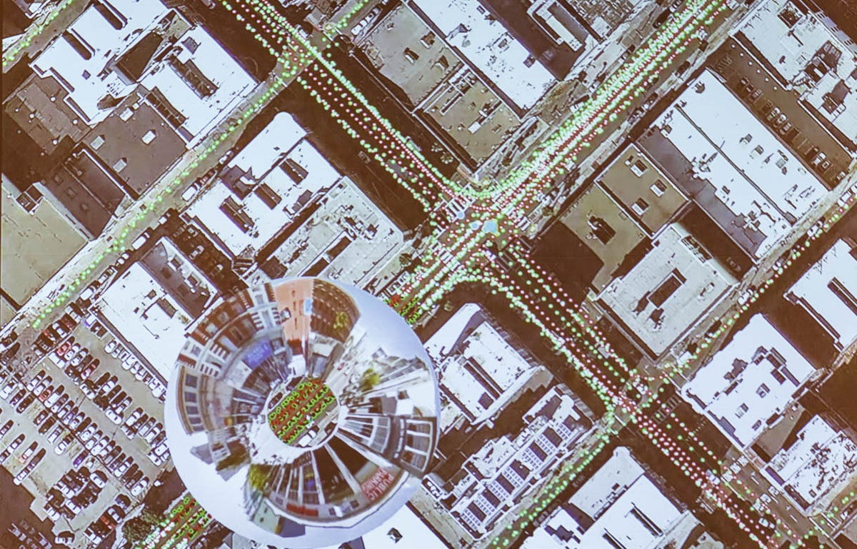
In Google's Ground Truth project, trained operators use Google's internal Atlas software to map out a virtual version of the world. The software can show real-world signs for reference purposes.
6 of 13 Stephen Shankland/CNET
Google's Ground Truth mapping
Ground Truth combines geographic data with Google's own data to try to figure out what's actually happening in the real world.
7 of 13 Stephen Shankland/CNET
Google's Ground Truth mapping
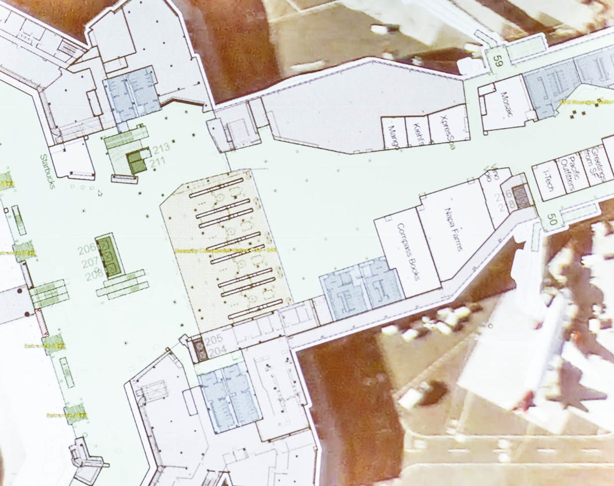
Newer Ground Truth work involves mapping interiors such as the San Francisco Airport -- including routes through them. Buildings have triple the information density as roads, posing more processing challenges for Google.
8 of 13 Stephen Shankland/CNET
Google's Ground Truth mapping
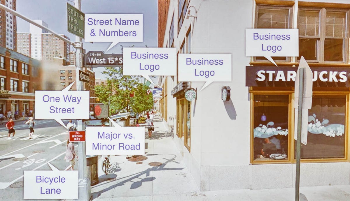
Google's mapping tools recognize features in the real world such as street markings, traffic signs, and company logos.
9 of 13 Stephen Shankland/CNET
Google's Ground Truth mapping
The Google Maps team reviews complaints of inaccuracies from users with the Atlas tool. In this case, the problem is with a road that's under construction.
10 of 13 Stephen Shankland/CNET
Google's Ground Truth mapping
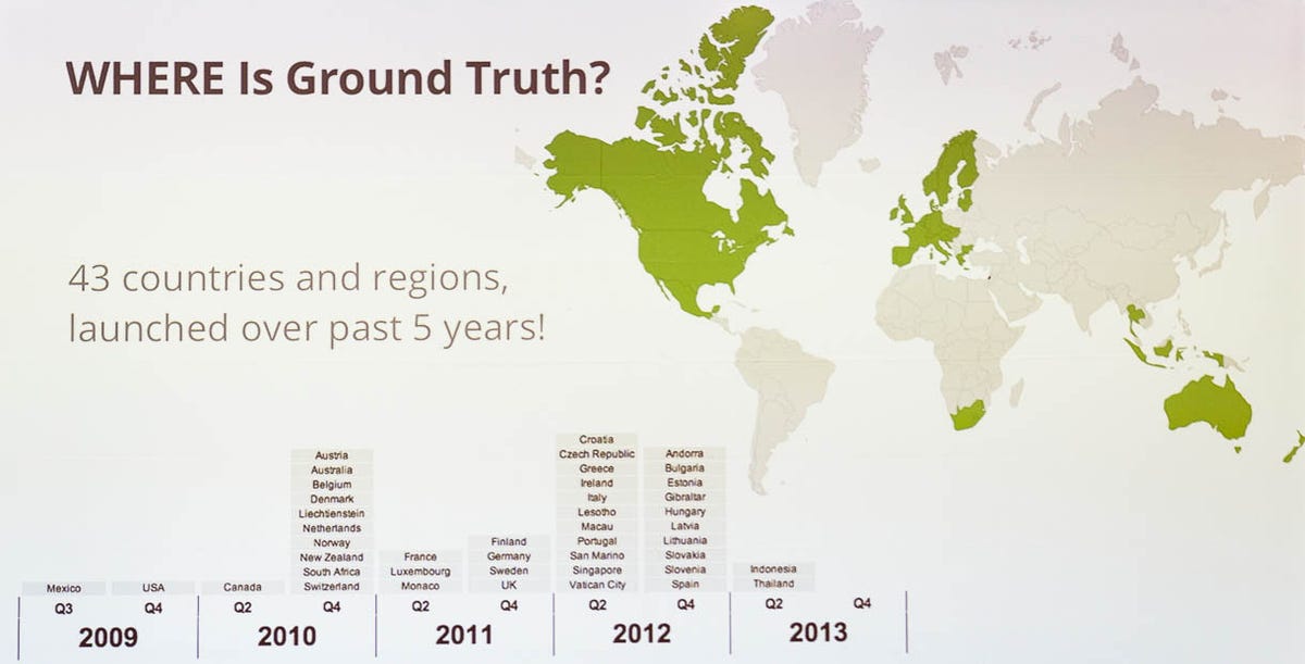
Ground Truth now is up and running in 43 countries. Once it's launched, Google must maintain the data, because maps go out of date constantly.
11 of 13 Stephen Shankland/CNET
Google's Ground Truth mapping
Another example of Google cleaning up and annotating inaccurate original data.
12 of 13 Stephen Shankland/CNET
Google's Ground Truth mapping
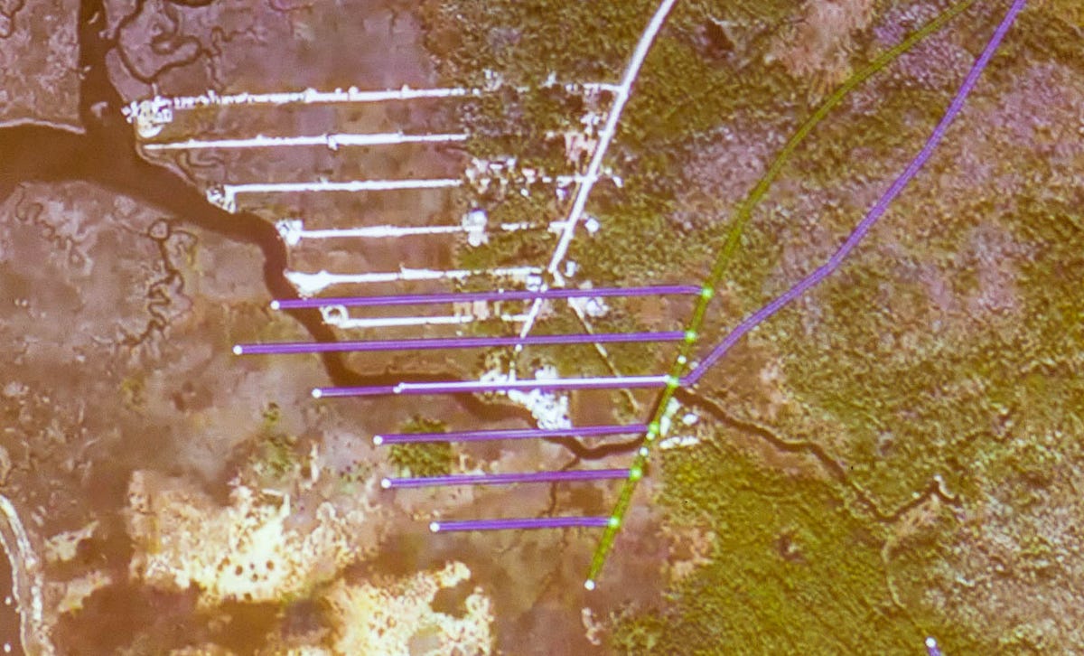
Part of the Ground Truth effort is correcting bad geographic data from sources such as governments. In cases where the data set is correct but distorted or shifted, Google can mathematically translate geographic items to new locations.
13 of 13 Stephen Shankland/CNET
Google's Ground Truth mapping
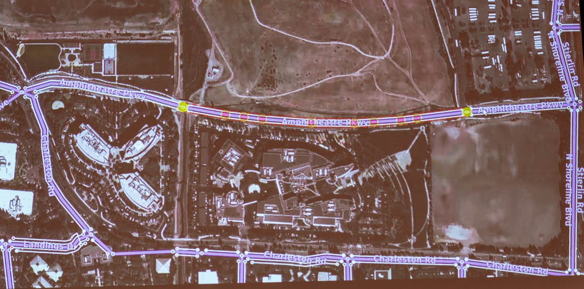
Google Maps employees carefully align road routes with satellite imagery using the Atlas software.