Google Maps sails down the Colorado River (pictures)
The Street View trekker winds its way through the Grand Canyon, past the Redwall Cavern, Vulcan's Anvil, and big horn sheep.
Dara Kerr
Dara Kerr was a senior reporter for CNET covering the on-demand economy and tech culture. She grew up in Colorado, went to school in New York City and can never remember how to pronounce gif.
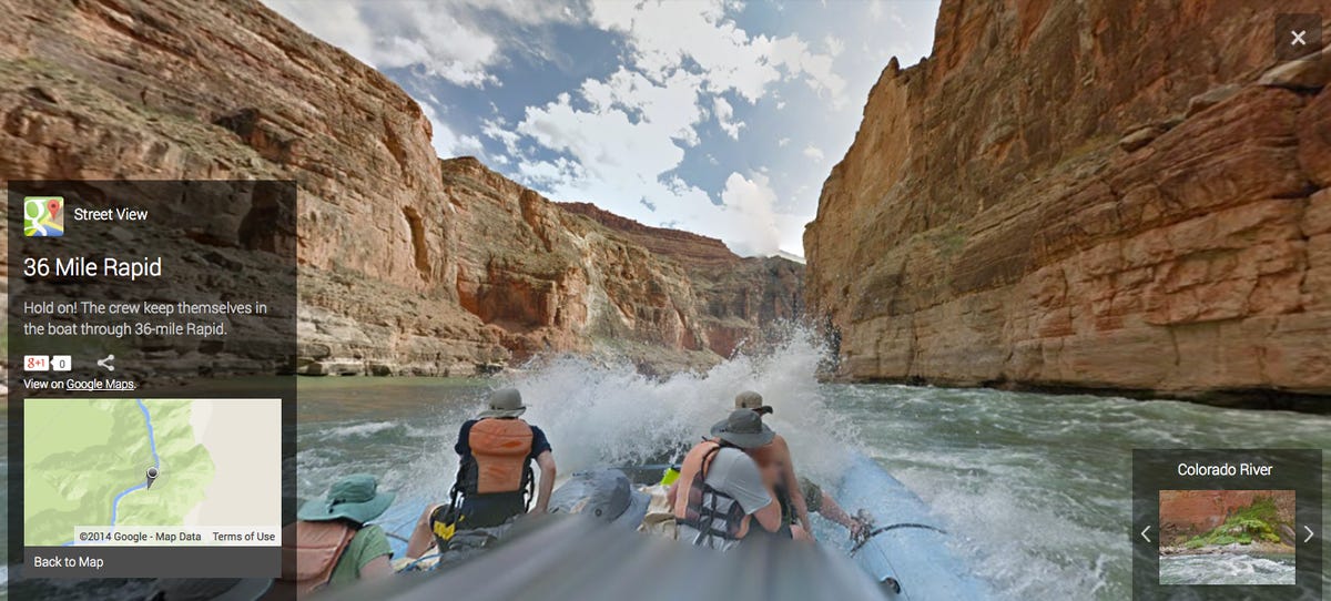
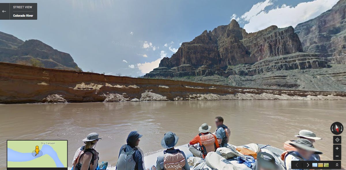
Google loaded its Street View trekker onto a raft and set sail down the country's most endangered river: the Colorado River. This journey takes in views of the Grand Canyon and all sorts of other natural and geological sights, like the 36-mile rapids seen here.
2 of 8 Google
Rambling river
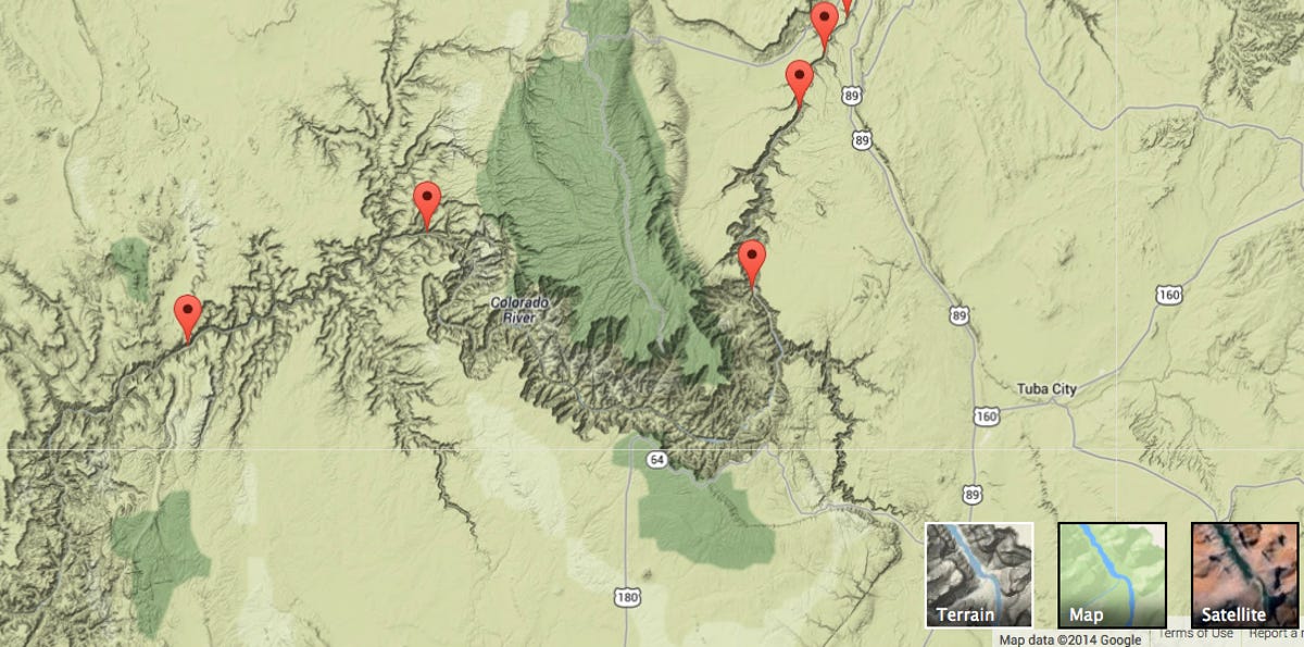
The Colorado River has been around for more than 6 million years, carving 1,450 miles down the Rocky Mountains, through the deserts of Utah, Arizona, and Nevada, and emptying into the Gulf of California in Mexico. The Grand Canyon is so massive that it can be seen from outer space. Yet, because of its being excessively dammed, diverted, and plumbed, the river has been deemed "America's most endangered river."
3 of 8 Google
Grand Canyon
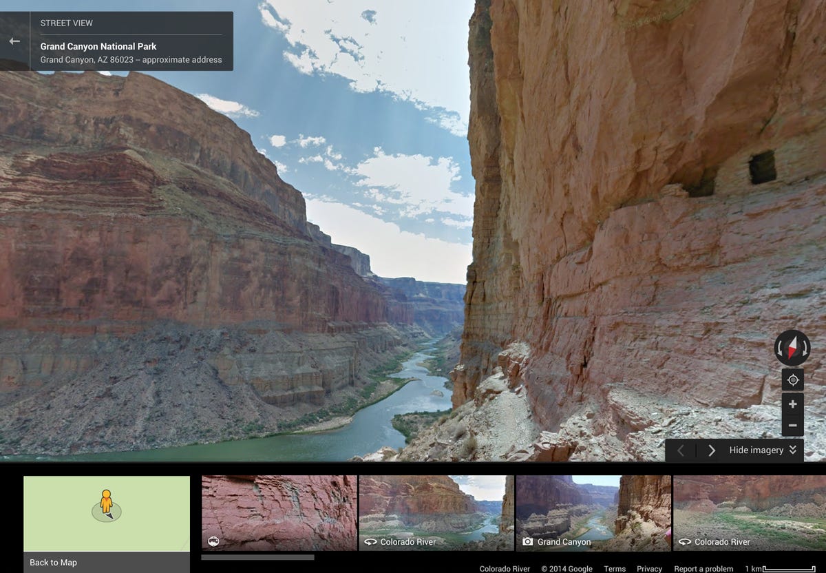
Google partnered with American Rivers conservation group to map out the course of the Colorado River and highlight attractions along the way. Seen here is Grand Canyon National Park in Arizona.
4 of 8 Google
Sandstone sideshow
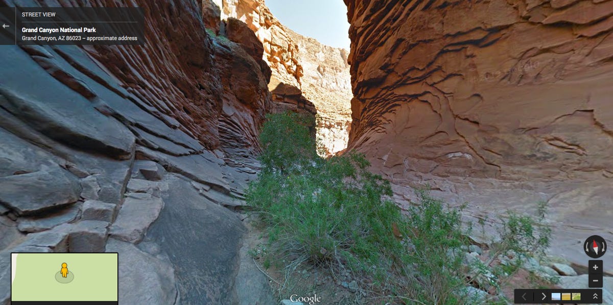
Pictured here is North Canyon, which is a side canyon of the Grand Canyon and is made of Supai sandstone.
5 of 8 Google
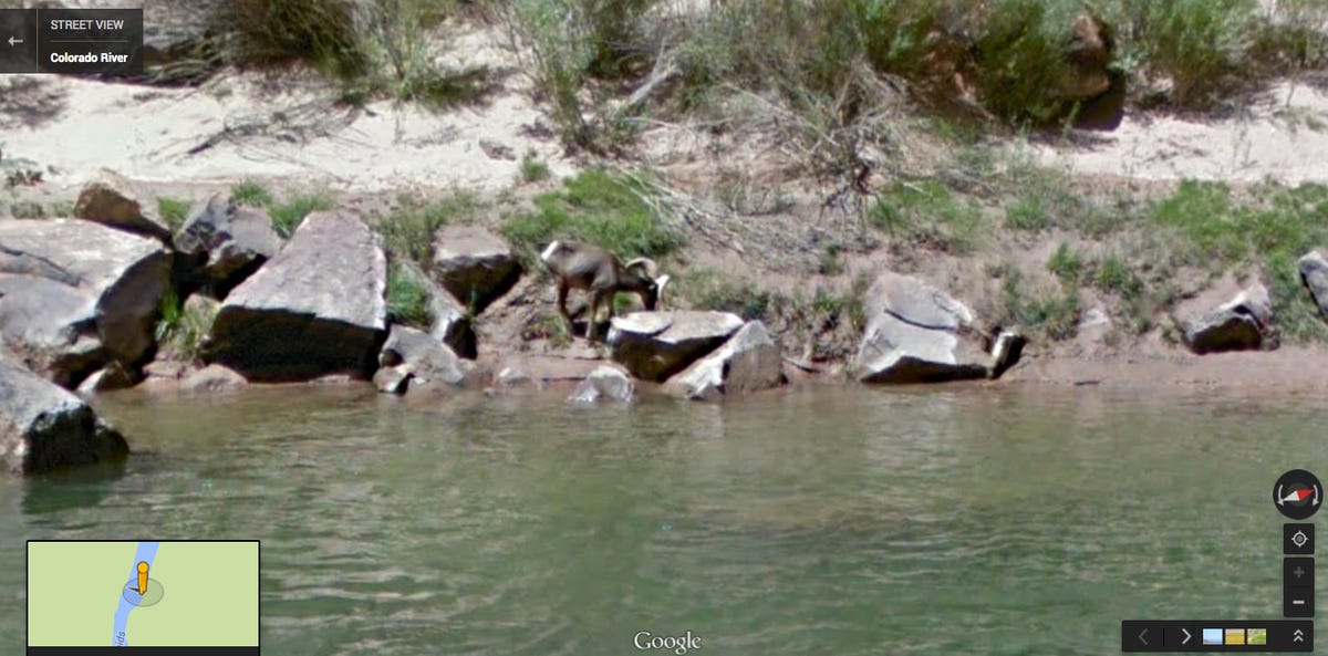
Sheep ahoy!
Google's Street View trekker managed to get images of local fauna, like this big horn sheep.
6 of 8 Google
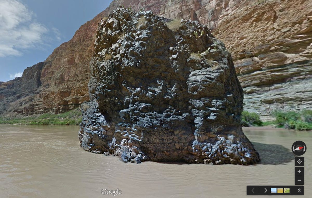
If Spock had a hammer
Vulcan's Anvil is one of the geological attractions along the Colorado River.
7 of 8 Google
Tapped out
Because of being overly dammed and diverted, by the time the Colorado River reaches the Gulf of California in Mexico it's barely a trickle. Seen here is evidence of the river’s decline with sedimentation along the river’s edge down by Lake Mead.
8 of 8 Google
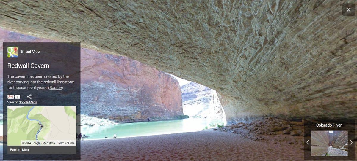
Cavernous
One of the sights along the route is the Redwall Cavern, which was created by the Colorado River carving into the redwall limestone for thousands of years.