Landsat has been gazing down upon Earth from space for four decades. As the next-generation LDCM satellite prepares to launch, we look at what Landsat has shown us so far.
Eric Mack
Eric Mack has been a CNET contributor since 2011. Eric and his family live 100% energy and water independent on his off-grid compound in the New Mexico desert. Eric uses his passion for writing about energy, renewables, science and climate to bring educational content to life on topics around the solar panel and deregulated energy industries. Eric helps consumers by demystifying solar, battery, renewable energy, energy choice concepts, and also reviews solar installers. Previously, Eric covered space, science, climate change and all things futuristic. His encrypted email for tips is ericcmack@protonmail.com.
To kick off this 40th anniversary gallery of images collected over the decades from NASA's Earth observation program, we might as well start with a Landsat shot that appeals to the narcissistic side of many CNET readers -- this is a view of the San Francisco Bay Area as of 2011.
2 of 15 USGS/EROS
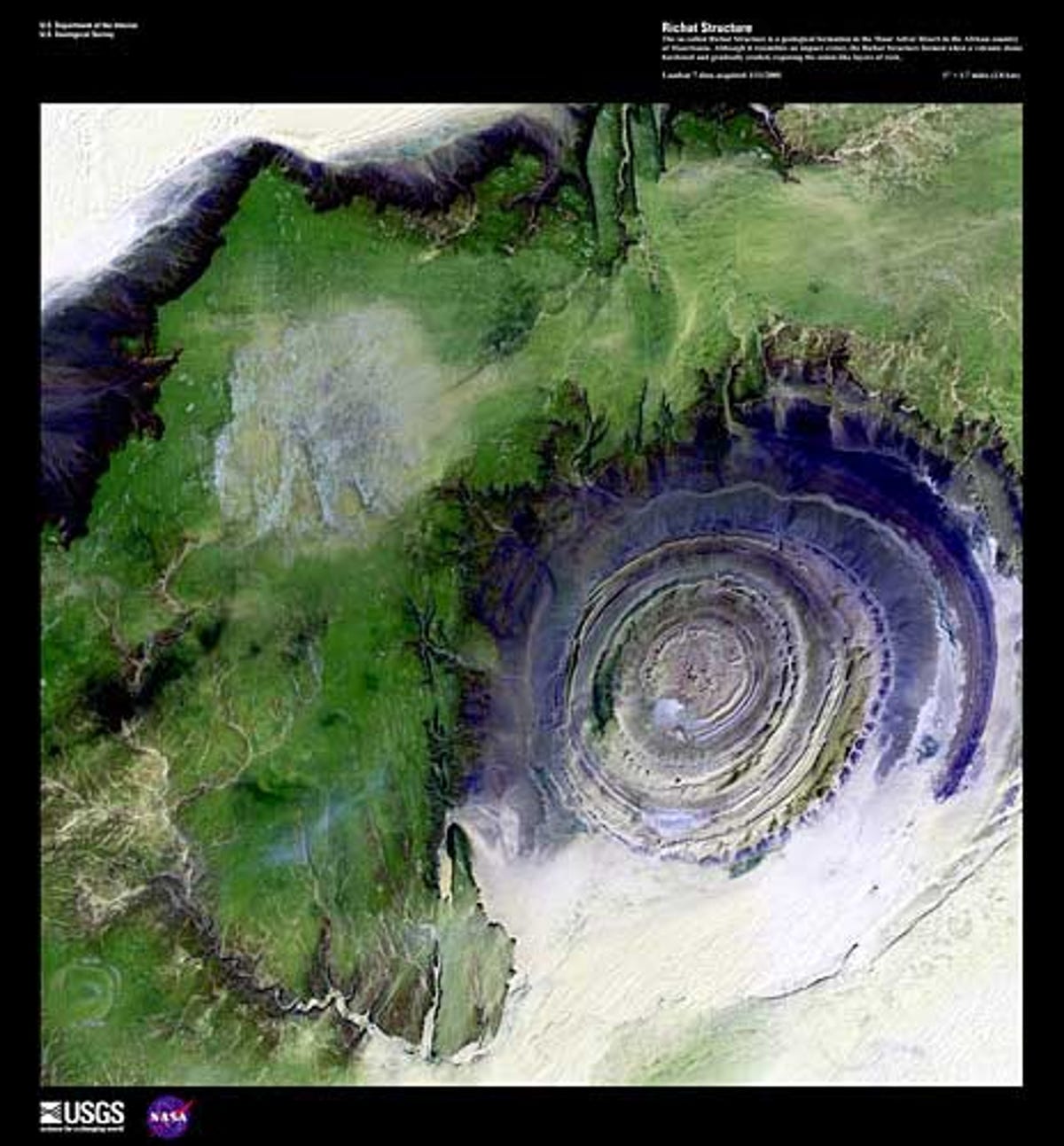
Mauritania's Richat Structure
As part of Landsat's 40th birthday celebration, NASA and the USGS have highlighted a handful of "earth as art" images. This one is a shot of the Richat Structure in the African country of Mauritania. It formed when a volcanic dome hardened and gradually eroded, exposing the dramatic rock layers.
3 of 15 NASA/GSFC
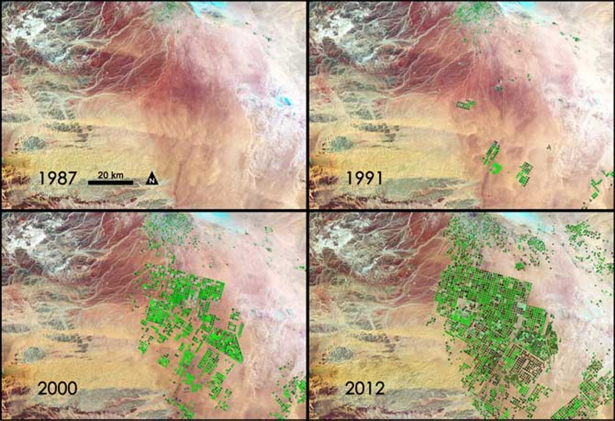
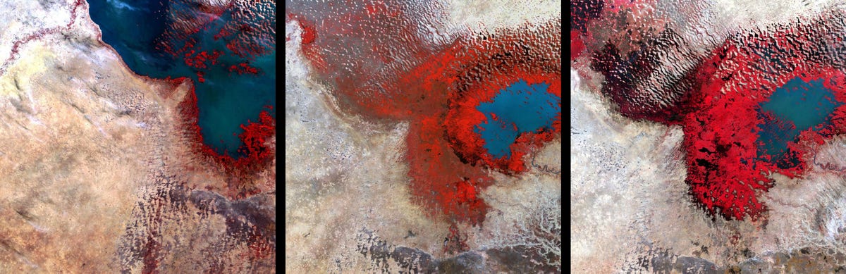
Seeing Saudi Arabia go green
Landsat images from the past 25 years demonstrate how Saudi Arabia has turned its arid lands green through tapping underground aquifers. Healthy vegetation appears bright green while dry vegetation appears orange. Barren soil is a dark pink, and urban areas, like the town of Tubarjal at the top of each image, have a purple hue.
4 of 15 USGS
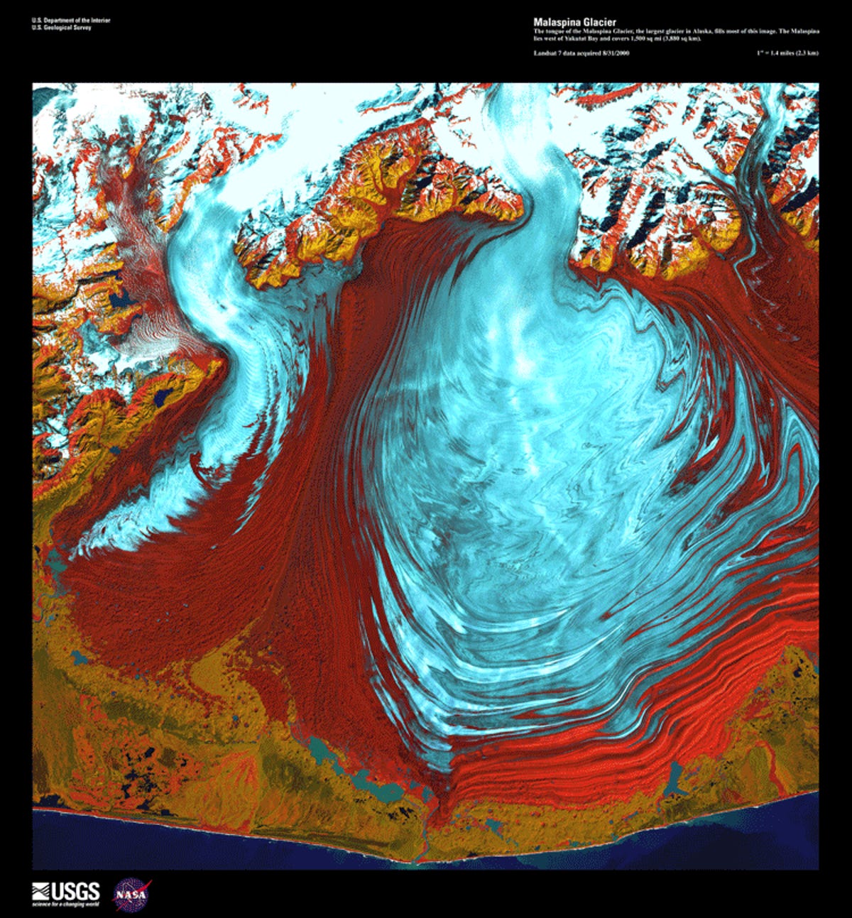
Alaska's Malaspina Glacier
Alaska's Malaspina Glacier as seen from Landsat, another from the "earth as art" collection.
5 of 15 USGS
Bolivian deforestation
These images show the progression -- from left to right -- of agricultural development's encroachment into a tropical forest in Bolivia.
6 of 15 USGS
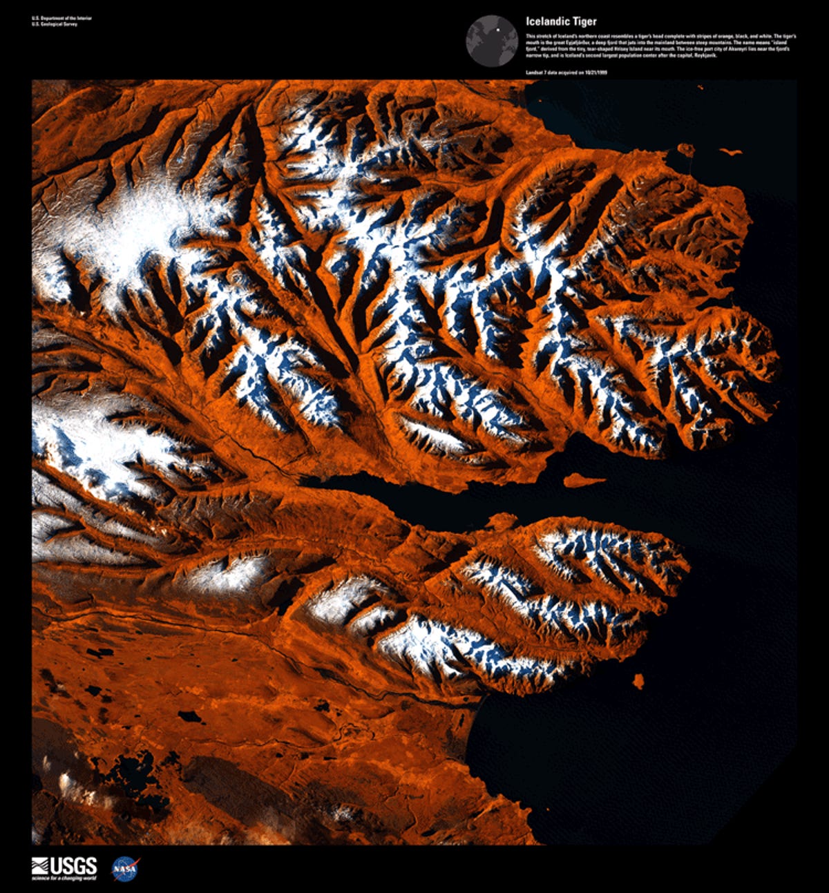
The Icelandic Tiger
When seen through Landsat's eye in the sky, Iceland's northern coast looks like a fierce tiger's head, right down to the coloration.
7 of 15 USGS
Shrinking Lake Chad
Between the first image on the left of Lake Chad -- taken in 1972 -- and the most recent taken in 2002 on the left, it's possible to see how much persistent drought has shrunken the body of water.
8 of 15 USGS
Real "Starry Night"
Another in the "earth as art" series, phytoplankton swirling in the waters around the Swedish island of Gotland mimic Van Gogh's classic "Starry Night."
9 of 15 USGS
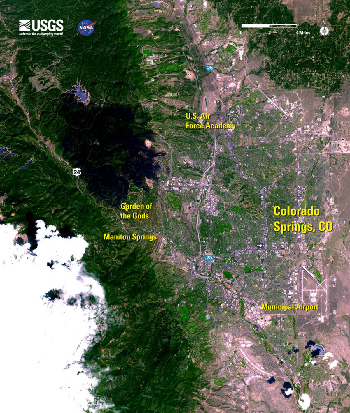
Waldo Canyon Fire
Landsat flew over the recent Waldo Canyon fire near Colorado Springs, showing the charred area in black.
10 of 15 USGS
Super Bowl XLVI
Here's Landsat's view of Lucas Oil Stadium in Indianapolis, shortly before Super Bowl XLVI.
11 of 15 NASA
Suburban Atlanta heat map
Landsat captured these thermal images of suburban Atlanta. Compare with the next slide of urban Atlanta for an illustration of the heat island effect.
12 of 15 NASA
Urban Atlanta's heat island
These thermal images of urban Atlanta show the "heat island" effect, especially when compared with the previous slide of a cooler suburban area just outside the city.
13 of 15 USGS
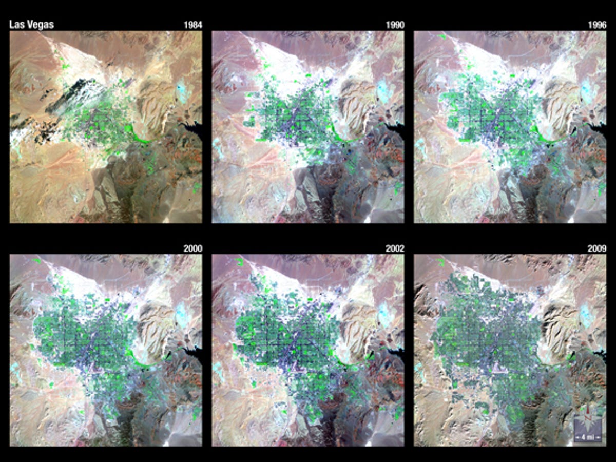
Las Vegas sprawls out
Landsat 5 spent more than 25 years chronicling the rapid expansion of the Las Vegas metropolitan area.
14 of 15 USGS
Mount St. Helens
This is a 1999 view of Mount St. Helens from Landsat.
15 of 15 USGS
Tsunami invades Japan
Captured shortly after a massive earthquake and tsunami rocked Sendai, Japan, in 2011, this shot from Landsat shows only a portion of the damage and infiltration of the landscape made by the wave and accompanying flood waters.