Traffic apps for iOS: Free, real-time road reports
These free apps can help you avoid road closures and delays as crews begin to clean up the mess Hurricane Irene left behind.


With the wind and water damage that Hurricane Irene left behind, the roads today in your area might be blocked or flooded. Whether you are trying to get back to the office, go out to the grocery store, or return home, you can save a lot of time by taking a look at traffic conditions before you run into a road block or traffic jam. There are a number of free iOS apps that can help you avoid trouble spots and traffic on the roads.
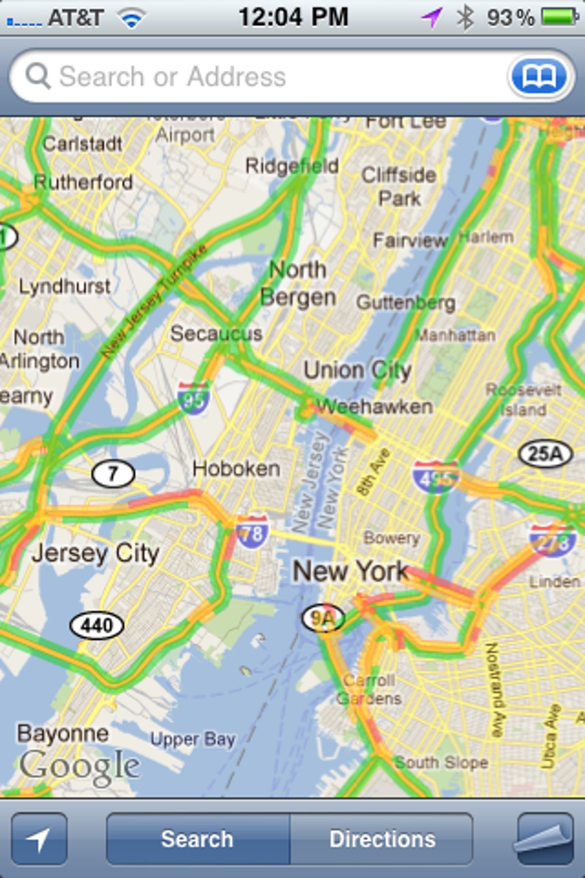
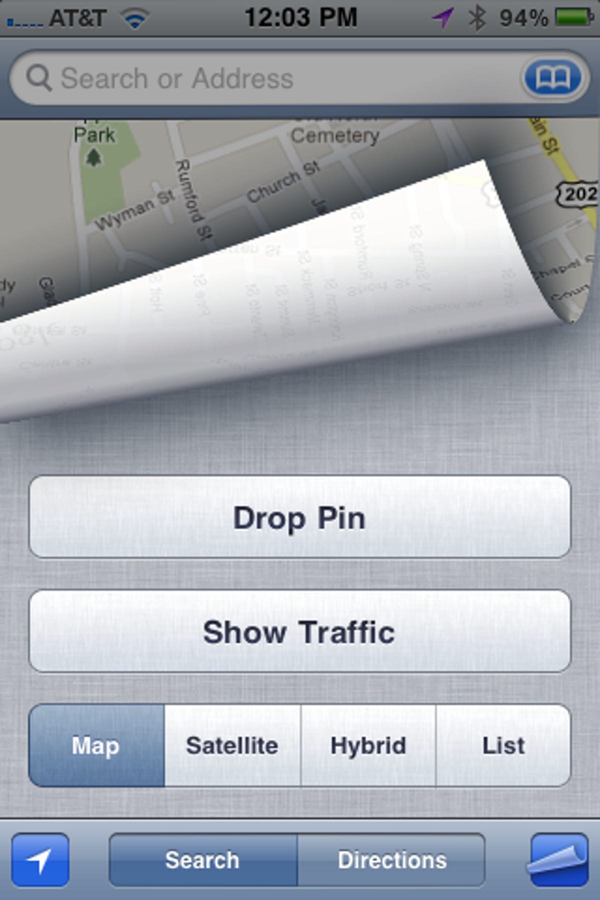
If you have an iPhone, then you already have a traffic app: Google Maps. There is a filter on Google Maps that shows real-time traffic conditions for major roadways. After launching Google Maps and tapping the arrow icon in the lower-left corner to find your current location, tap on the curled-paper icon in the lower-right corner and tap the Show Traffic button. It returns you to your map, with color-coded traffic conditions. For highways, the colors indicate:
- Green: More than 50 mph
- Orange: 25-50 mph
- Red: less than 25 mph
Google uses crowdsourcing for its traffic data:
When you choose to enable Google Maps with My Location, your phone sends anonymous bits of data back to Google describing how fast you're moving. When we combine your speed with the speed of other phones on the road, across thousands of phones moving around a city at any given time, we can get a pretty good picture of live traffic conditions. We continuously combine this data and send it back to you for free in the Google Maps traffic layers.
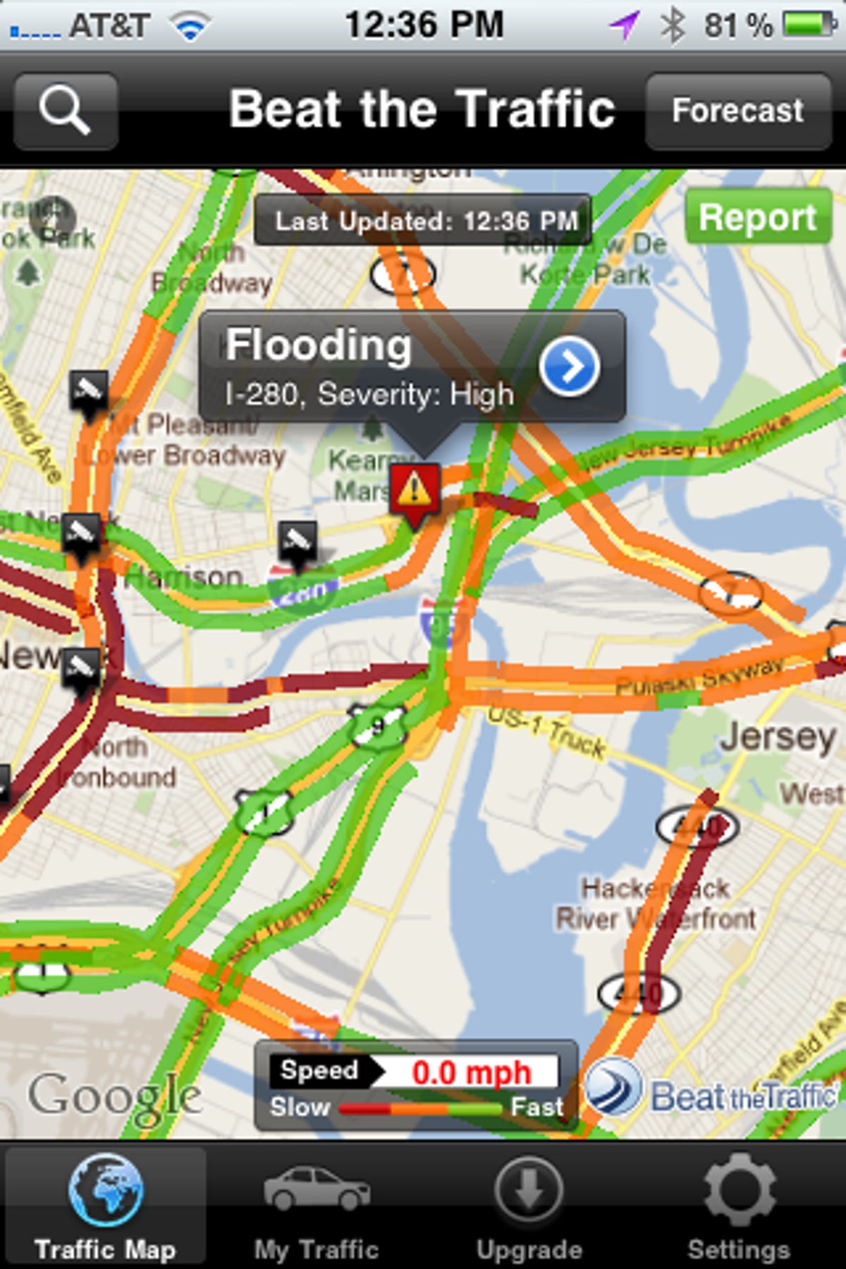
For a second opinion, there are a number of free apps that provide color-coded maps similar to Google Maps' traffic layer. Beat the Traffic is a free app that shows where traffic is moving or slow, and it also provides accident alerts. A small red-and-orange icon with an exclamation point indicates there was a recent accident, and if you tap on it, you'll find some information about the location, time, and severity of the accident. It appears that not all of the alerts are recent; on Monday morning, a bus accident from Sunday night was still listed in the NYC area. It did, however, show that there was flooding this morning on I-280 East between Newark and Jersey City, a potentially useful piece of information, post-Irene.
It also displays icons for traffic cams, which you can view by tapping on the icon and then the blue arrow to the right of its description. I checked out a number of the traffic cams in the New York City area and found that the majority were still showing images from overnight, so you might not get current conditions from a traffic camera. If you do find a regularly updated camera for a stretch of road you travel regularly, you can save it to a favorites list for easy access.
By default, the Beat the Traffic map shows live traffic information, but if you click on the Forecast button in the upper-right corner, you can get a traffic forecast for up to 2 hours out. You can also report an incident from your phone by tapping the green Report button in the upper-right corner, dragging the pin to a spot on the map, and filling out a form where you can describe an accident, a delay, road work, and so on.
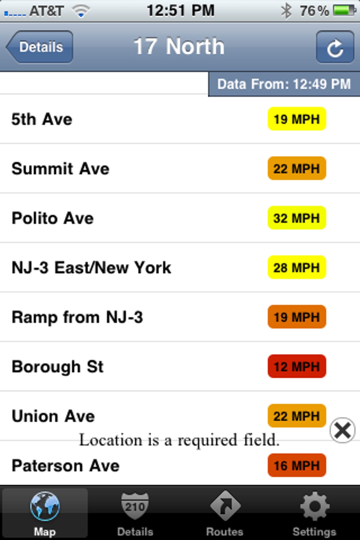
Sigalert.com is another free app that shows current traffic conditions with icons for alerts and traffic cams. Its map isn't as clearly labeled as Beat the Traffic's, but it shows the speed of traffic of a stretch of road. Just tap on the map, and for that area you'll get a list of incidents, freeways with traffic information, and traffic cams. I found a number of ramps and roads closed because of flooding in the NYC area this morning and traffic lights out in Connecticut, so the incident list appears to be updated frequently. If you tap on a freeway from the list, you'll see the average speed near each exit around the area you tapped on the map, which is more useful than seeing a green or red stripe on the map. Also, you can shake to refresh the map--handy should you be at the wheel and checking traffic (which isn't advisable unless you are stopped). Lastly, if you sign up for a free My Sigalert account, you can set up personalized routes that show only traffic conditions on the roads on your trip.
Inrix Traffic is a universal iOS app that provides the familiar green-orange-red traffic conditions on the map, but also includes a unique comparative traffic feature. Tap on the dotted road icon at the top of the screen, and it shows you how current road conditions compare with normal conditions. Black means traffic is worse than usual, gray means it's about average, and light blue means things are moving along a bit better than usual. Next to the Comparative Traffic button at the top is a button that lets you forecast traffic conditions based on your departure time. You can move a slider to see how conditions change in 15-minute increments.

Inrix Traffic's reporting feature is easy--almost too easy. It takes only two taps on the screen to report police activity, an accident, or that the traffic conditions are wrong on the map (that is, green should be red or vice versa). It's so easy to make a report that in the process of testing out the app this morning, I think I mistakenly made two reports in the Concord, N.H., area. Sorry, Concord motorists!
These are the best free apps of the handful I tested this morning. Results may vary depending on your location, so try out a few to see which works best in your area. And if you find an app you really like, please share it with us in the comments!