Take down the enemy, while getting in some shopping
The GeoXray software lets you click on a satellite image and get information about a given location. Now DARPA wants to beef up its capabilities.
Ever been out on patrol and had a sudden urge for chapli kabobs with a side of bendai?
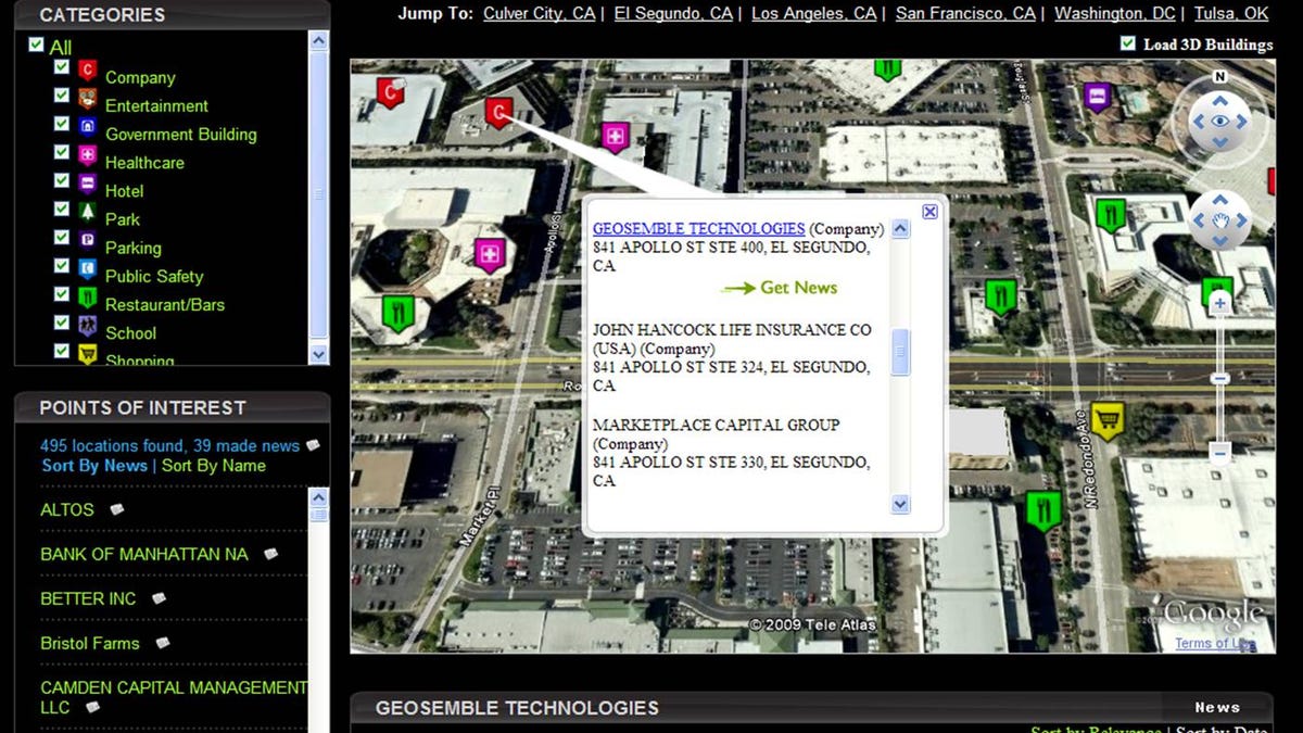
That's the sort of mix-and-match experience that could be addressed through a new deal between DARPA and Geosemble Technologies, which makes a product called GeoXray that aims to quickly answer the question "What's around here?" for both government agencies and civilian users. In a nutshell, it works this way: you can peruse dining options or identify enemy assembly areas simply by clicking on aerial images of your area of operations.
GeoXray uses artificial intelligence to assign textual keywords to geospatial datasets, which in turn allows the customer to view information associated with a specific location. The data is summarized and displayed chronologically on what the company calls an "intuitive, user-friendly interface."
In its new DARPA program, Geosemble will expand its range of information sources beyond text to include video and audio sources.
"An integrated interface makes it simple for anyone to view a satellite image of any place in the world, then click on a location or object to automatically extract relevant information," DARPA program manager Todd Hughes said in a statement. "The application uses automatic techniques to accurately display geographically relevant news articles, business intelligence, events and databases onto satellite and aerial imagery."
The El Segundo, Calif.-based company is already pitching GeoXray as a quick and efficient way for shoppers to scout out retail opportunities without having to walk or drive around. It's easy to imagine this program linked to a Zillow-like real estate site.
"The seamless integration of news and data with imagery and maps brings an important new capability to government users, and has game-changing implications for online publishing and real estate," said Andre Doumitt, Geosemble CEO. "There is a lot of imagery available out there - high resolution, 3D, ground level, etc. This DARPA program enhances our position as the 'data inside' provider for those who need accurate and timely intelligence about their imagery, with accuracy down to the building level."