Underground medieval palace revealed by surface survey
The layout of a medieval city underground at the site of Old Sarum has been revealed through the use of non-invasive digital mapping technologies.


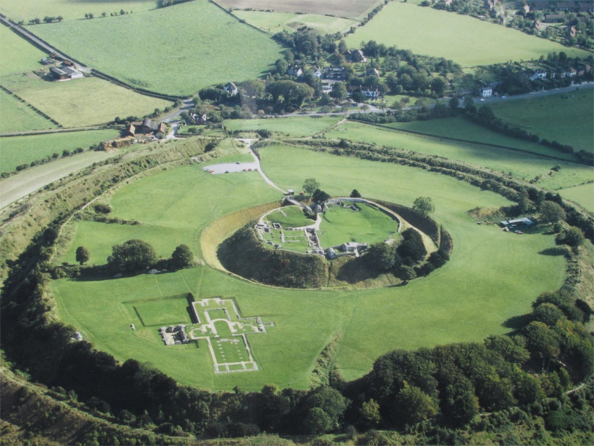
Old Sarum in Salisbury, the UK, is rich with history, dating back 5,000 years. During the Iron Age, it became the site of a hill fort, during the Roman occupation of Britain hundreds of years later, it became a military outpost and, during the Middle Ages, the site of a bustling city.
Although much of these ruins have been excavated over the years, there are sections that remained underground: the Inner and Outer Baileys of the ancient hillfort, where a city arose in the 11th Century, complete with a castle and cathedral -- and stood for over 300 years, declining in the 13th century when New Sarum -- Salisbury -- rose, and the city relocated.
Although the existence of this city was known, its layout was not -- and now a number of surveys have revealed the network of buildings -- including what was probably one of the largest royal palaces of the time.
"Archaeologists and historians have known for centuries that there was a medieval city at Old Sarum, but until now there has been no proper plan of the site," said Kristian Strutt, Experimental Officer and Director of Archaeological Prospection Services at the University of Southampton.
"Our survey shows where individual buildings are located and from this we can piece together a detailed picture of the urban plan within the city walls."
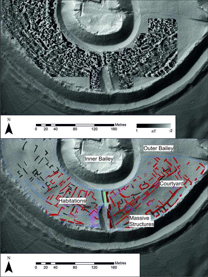
The survey consisted of a range of technologies. Earth resistance -- that is, how soil resists the flow of electricity -- and magnetometry, which records spatial variation in the Earth's magnetic field, were employed in the Outer Bailey, while ground-penetrating radar was used in the Inner Bailey. The team also used electrical resistivity tomography.
What the team discovered includes a series of massive structures around the outer defensive wall, probably also defensive in nature; an open courtyard behind these structures, possibly a thoroughfare, or a space for mustering troops or resources; residences in the south east and south west along the Inner Bailey ditch; evidence of kilns and furnaces; and evidence that the site was used for quarrying after the city's decline.
They also found, around the courtyard, a 170m long by 65m wide complex, which contained what appears to be a hall 60 metres long, walls up to three metres thick a tower and multi-storey buildings, supported by large columns.
"The location, design and size of the courtyard complex strongly suggests that it was a palace, probably a royal one," said Dr Edward Impey, Director-General of the Royal Armouries -- one of Britain's leading experts on medieval structures. "The prime candidate for constructing it is perhaps Henry I sometime in the early 12th Century."
The survey, which took place as training for postgraduate and undergraduate students at the University of Southampton, with the permission of English Heritage, will resume in 2015.
"Our research so far has shown how the entire outer bailey of the monument was heavily built up in the Middle Ages, representing a substantial urban centre," Strutt said. "Results have given us compelling evidence as to the nature of some of the structures. It is clear, however, that there is more non-intrusive work that could be carried out to further expand our understanding of the site."