Los Alamos wildfire reaches lab, forces evacuation
A 49,000-acre wildfire reaches the national lab's southern boundary and triggers the mandatory evacuation of about two-thirds of the county's residents.


- Shankland covered the tech industry for more than 25 years and was a science writer for five years before that. He has deep expertise in microprocessors, digital photography, computer hardware and software, internet standards, web technology, and more.

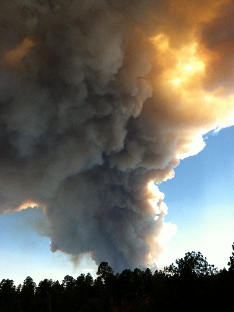
The Las Conchas wildfire has spread to part of Los Alamos National Laboratory property and triggered an evacuation of most of the the Los Alamos town residents nearby.
The fire started yesterday in the mountains southwest of Los Alamos and spread rapidly, stoked by winds, dry conditions, and high temperatures. Today, it grew to 49,000 acres and reached LANL's Technical Area 49, a site on the southern border of the lab's 28,000-acre (43 square mile) property.
"Air crews dumped water at the site within the Lab's Technical Area 49 and brought the blaze under control. The area had been thinned of ground fuels in recent years. About one acre burned and the lab has detected no off-site releases of contamination," a U.S. Forest Service statement said. "No other fires are currently burning on lab property, no facilities face immediate threat, and all nuclear and hazardous materials are accounted for and protected."
Los Alamos County's 18,000 residents live in two regions--about two-thirds of the population in the Los Alamos town site proper and about one-third to the east in White Rock. The residents of Los Alamos were ordered to evacuate on Monday, according to the Forest Service's Las Conchas wildfire site.
The fire spread quickly on Sunday in forested areas to the southwest of the lab and residential areas and now overlaps with large areas that burned earlier, most notably the Cerro Grande fire of 2000 that spread west of Los Alamos then burned hundreds of houses and brushed up against LANL property.
The Cerro Grande fire scorched thousands of acres of mountain forests west of the city and lab, leaving less fuel to burn now. Another fire, the Dome Fire from 1996 that was more to the south, also burned away thousands of acres of forest. However, on Sunday, new fires from blowing embers sparked as far away as a half mile from the main fire, the Forest Service said, highlighting the fact that a fire can move fast in dry, windy conditions.
Firefighting in the area is complicated by a patchwork of governmental jurisdictions. LANL is a Department of Energy site operated by subcontractors. Los Alamos County has its own local government. Bandelier National Monument to the south has borne much of the brunt of the Las Conchas Fire. To the west of the town and lab is Santa Fe National Forest (though the state capital city of Santa Fe itself is well to the east). Several Native American populations--the pueblos of San Ildefonso, Jemez, Cochiti, and Santa Clara--are in the region. Farther west, nearer to the area the Las Conchas fire started, is the an 89,000-acre historic ranch site called the Valles Caldera National Preserve.
Firefighting resources at the Las Conchas fire include three helicopters, two Forest Service Hotshot crews, nine hand crews, five bulldozers, and thirteen fire engines.
LANL said it will remain closed Tuesday to all but essential personnel. County residents can listen for updates over the radio on AM 1610.
Los Alamos National Laboratory's core mission involves nuclear weapons, but the thousands of scientists there also are involved in dozens of other fields. Its headquarters are at Technical Area 3 just to the southwest of downtown Los Alamos, but the lab's operations are scattered across dozens of facilities located in an area that's largely wilderness.
Below is a time-lapse video of the fire as viewed from several miles east in Santa Fe.