Leaning Tower of Pisa 3D-mapped with handheld laser
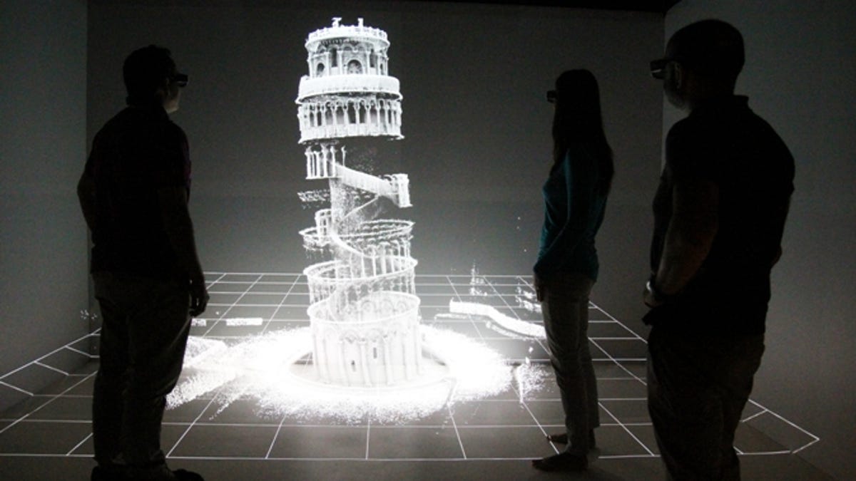
The Zebedee scanner sways as the user walks, gathering data for a map that can be displayed as a point cloud in a 3D projection room.


3D laser scanners have been used to map everything from mine shafts to old homes, but an Australian team has created the first interior map of Italy's famous Leaning Tower of Pisa using a handheld scanner.
Researchers from CSIRO, Australia's national science agency, used a Zebedee scanner, which sways around on a spring as its user walks through a structure to be mapped.
The device enabled the group to produce a detailed 3D map of the 14th-century icon, despite the tower's complex architecture and cramped stairs.
Zebedee uses an infrared LiDAR laser to measure the distance to various surfaces in the area being scanned. The spring changes the user's walking motion into a sweeping motion for the scanner. It also has an inertial sensor to measure its rotations.
With its software package, after the scan, the range and inertial measurements are converted into a 3D map in less time than it takes to collect the data.
During a 20-minute ascent inside the askew building, the scanner took millions of data points, capturing its stonework and other details -- there's a video of it here. The map can then be displayed as a point cloud in a 3D projection room.
"This technology is ideal for cultural heritage mapping, which is usually very time-consuming and labor-intensive," Jonathan Roberts of CSIRO's Computational Informatics Division said in a release.
"It can often take a whole research team a number of days or weeks to map a site with the accuracy and detail of what we can produce in a few hours."
The Zebedee mapping system has been commercialized as the ZEB1 scanner from UK-based 3D Laser Mapping.
It could be used to help reconstruct heritage sites like the Tower of Pisa in the event of catastrophic earthquake or fire damage. Meanwhile, it's also being used to scan underground coal mines as well as crime scenes. Check out the CSIRO Zebedee vid below.