GPS gadget aims to ease geotagging
ATP's $99 GPS Photo Finder aims to automate the process of adding location data to digital photos, which today is usually a tedious manual process.


- Shankland covered the tech industry for more than 25 years and was a science writer for five years before that. He has deep expertise in microprocessors, digital photography, computer hardware and software, internet standards, web technology, and more.
ATP Electronics has announced a device called the GPS Photo Finder that's designed to take some of the trouble out of geotagging your photos.
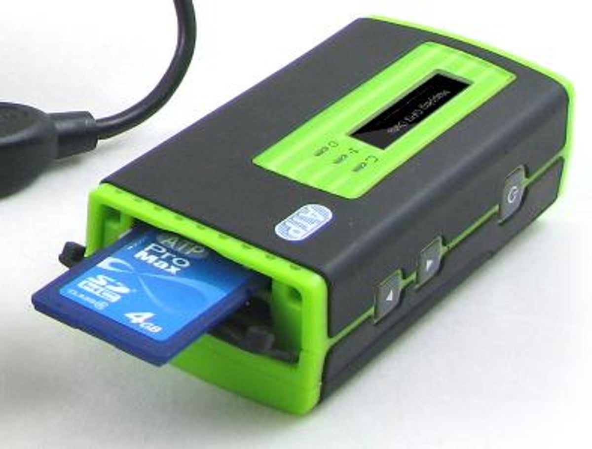
The device, like many GPS receivers, keeps track of its location based on signals from satellites. What's different is that instead of marrying that location data with your photos on a computer using special software, the Photo Finder has an SD card slot and handles the tagging by itself, the company said. When you copy photos to your computer, the location data is embedded in the JPEG files.
The device should go on sale for $99 in the next couple weeks, said marketing manager Jeffray Hsieh. It also includes a USB port that lets you plug in a flash card reader if your camera uses CompactFlash memory cards or some other format. It's based on the highly regarded SiRF Star III GPS chip.
Sadly, the device supports only JPEG files at this stage. Most photographers shoot only JPEG--indeed, most cameras have no other option--but higher-end models such as SLRs also support raw files, which record the image sensor data with no in-camera processing. And the kind of enthusiasts who shoot raw sometimes are the kinds of enthusiasts who like to geotag photos.
"We'll definitely continue to develop additional support for raw formats," Hsieh said, "but because of the fragmentation between camera manufacturers, it will be a challenge."
The company also plans on adding the ability to export track logs as a KML route file, a record of a person's trip that can be imported into Google Earth software. The company also is planning on adding altitude and direction data that some GPS devices can supply.
The Photo Finder also includes a screen that's can display the time, a feature designed to help nip geotagging time zone complications in the bud.
Personally, I geotag photos for personal archival reasons: which church/mountain/beach was that photo? Various Web sites also can take advantage geotagged photos.