Google Maps gets Sydney public transport
Navigating the mean streets of Sydney just got a bit easier with the inclusion of Sydney's public transport in Google Maps.


- Webby Award honoree, 2x Gold Telly Award winner
Navigating the mean streets of Sydney just got a bit easier with the inclusion of Sydney's public transport in Google Maps.
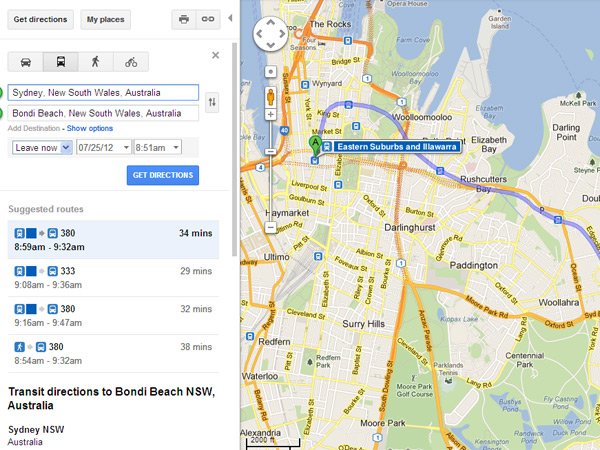
As discovered by Lifehacker, Sydneysiders now have the opportunity to plan their route and get directions using public transport. Other cities around Australia that have public transport information directly integrated with Maps include Perth, Adelaide and Canberra.
Previously, Sydney travellers were only able to access information and directions on the Light Rail system via the Google Transit hub. However, the navigation isn't fail-proof, as in one of our searches it instructed us to walk across the harbour to get to a ferry stop on Cockatoo Island.
Melbourne and Brisbane commuters are still waiting for their public transport integration with Google Maps.