Google mapping spec now an industry standard
KML, a Google language to describe map data, is now an industry standard. Let a thousand online map flowers bloom?


- Shankland covered the tech industry for more than 25 years and was a science writer for five years before that. He has deep expertise in microprocessors, digital photography, computer hardware and software, internet standards, web technology, and more.
Members of an industry group called the Open Geospatial Consortium have approved Google's KML technology as an open standard for describing some geographic data.
KML is used to manage the display of geospatial information in Google Earth, the company's software for flying over the surface of a virtual globe. With its 3D coordinate-based system, people can create models of city buildings, draw a line showing where they hiked, or overlay their own custom place names on a generic map.
Google already shared its KML format openly, and others had used it in software products, but Google now hopes that its status as an official standard will decrease barriers to further adoption.
"What OGC brings to the table is...everyone has confidence we won't take advantage of the format or change it in a way that will harm anyone," said Michael Weiss-Malik, Google's KML product manager. "The goal is to prevent market fragmentation," in which different technology uses different standards.
File formats may sound mundane, but they can give strategic value to those who control them as a gateway to the data held by people and companies. In one high-profile example, open-source allies launched an attack on Microsoft's Office stronghold with the OpenOffice.org software, which could mostly read Microsoft's file formats.
One front in that war was an effort to set OpenOffice's file formats as an industry standard called ODF (OpenDocument Format), a move Microsoft countered with its own OOMXL effort, which Google opposed.
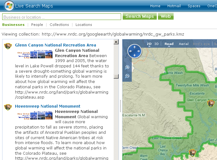
It didn't seem like there was powerful reluctance to use KML. For example, the latest Virtual Earth and Live Maps technology from Google rival Microsoft can use KML to let users export user information to navigation devices. And the Microsoft site can overlay KML files from the Internet onto its Live Maps--here's a (slow-loading) link to one from the National Resources Defense Council that describes expected effects from global warming to various national parks, along with the park boundaries.
But standardization will make KML more palatable, Weiss-Malik said. "Governments like to say they can publish to OGC KML instead of Google KML," he said.
And he expects to see a new era blossom of personal map publishing, all powered by KML. "We're just starting to see the birth of map publishing," he said.
KML stands for Keyhole Markup Language. It initially was developed by Keyhole, the satellite imagery company Google acquired in 2004. Keyhole's technology was built into the Google Maps site and the Google Earth software.
The standard, which geographic information system (GIS) software specialist Galdos Systems helped bring to the standardization process, is based on KML 2.2. The official KML standard can be downloaded from the OGC Web site.