Google launches Street View, Mapplets
Google Maps now has Street View, a new way to look at maps.


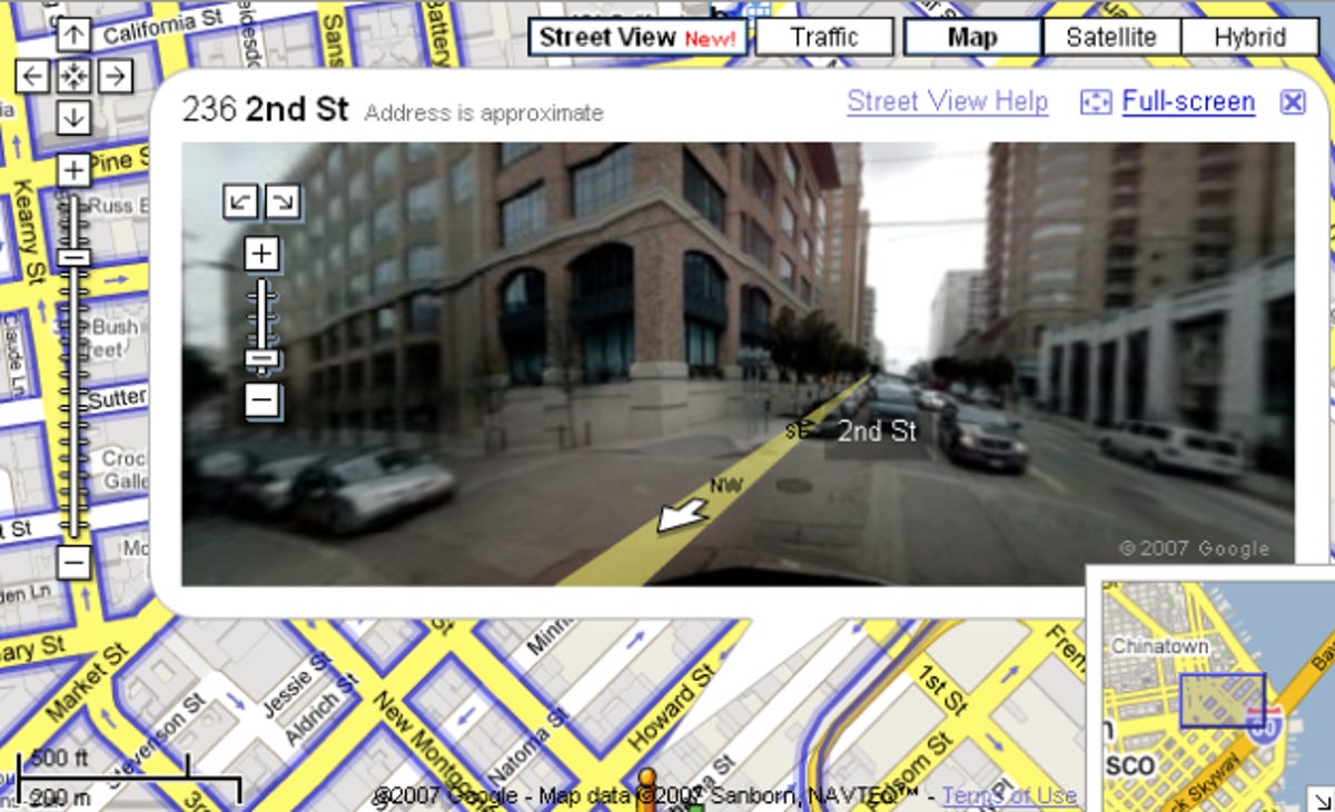
This morning Google added Street View, an all new way to browse Google Maps. Launching with five major cities, Street View joins satellite and traffic maps as new ways to view geography. When in an area with a Street View, users can toggle the mode to navigate within a 3-D photograph using their mouse or keyboard shortcuts. Users get their own "person" that shows which direction you're looking at.You can also just click and drag them to new locations. The experience is a mix between Quicktime's VR environment and Microsoft Live Labs' PhotoSynth project since users can zoom in closer in any shot. Google describes it as "immersive photography."
Google also announced the launch of Mapplets, which joins the My Maps feature they launched in early April. With Mapplets, users can create their own maps mash-ups, which can be combined and toggled on and off. The example shown at this morning's press demo was a Chicago transit map, which could be mixed up with other maps shared or uploaded to the service.