Google Earth adds weather to its repertoire
Google Earth finally adds a weather layer. Now you can obsessively check the weather in foreign cities again and again.


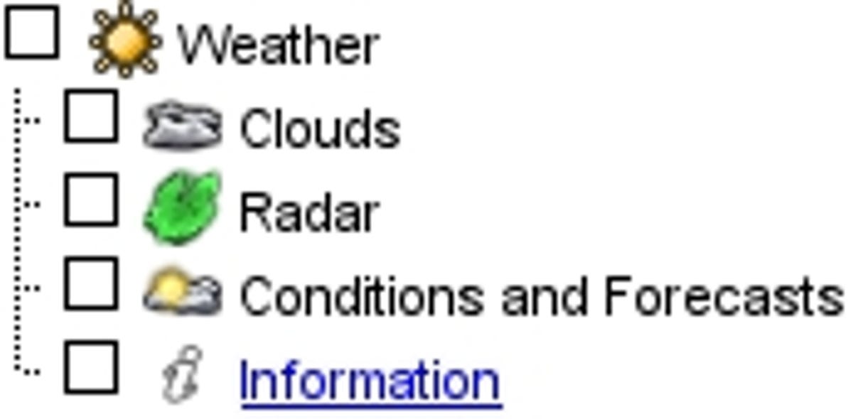
As of today, Google Earth can finally tell you what the weather is like while you zoom around the 3D representation of our planet. The app has a new layer that lets you toggle cloud cover, Doppler radar, and conditions and forecasts, which will show you what's on tap in each region using information aggregated from Weather.com. There's also an "information" link that has more background about each of the services and links to download the 6- and 24-hour cloud animations, which can be controlled using playback buttons in the top right of your screen. It looks just like you've seen on any TV weather report, except you have complete control on the playback slider, and can drag is backward and forward ad nauseum to bend the clouds to your will (it's great fun).
I couldn't manage to get the "conditions and forecasts" sublayer to activate with the latest build for Windows, but maybe that's just me. Everything else works marvelously, including the Doppler radar that Google claims is "near real-time," which is a reasonable considering it's updated every 15 minutes--about what you'd find at most weather sites. The data for Doppler comes from Weather.com and is limited to the contiguous United States, with plans to roll it out to Alaska, Hawaii, Puerto Rico, and Europe "shortly." All other regions of the globe are limited to cloud cover and forecasts, which Google pins at somewhere around 50,000 cities worldwide.
The update doesn't really offer anything you can't get on a standard Weather site, but one of the joys of Google Earth is being able to combine layers on top of one another to maximize the amount of information you can see about any given area. If you've already got Google Earth installed, you can access the new layers by updating your build through the help menu. New users simply need to download and install the newest version.
On a side note, it's surprising how many Google Earth features never seem to carry over to Google Maps besides satellite imagery and traffic. At the same time, Google Earth gets to flex its muscles a little more with eye candy like 3D geography and buildings along with these new cloud animations because of hardware utilization. Google has never said it's trying to achieve parity between the two, but with the introduction of Mapplets, Street View, and MyMaps, Google Maps is definitely splitting off from its software sibling.
[via Google LatLong blog]