Geocoding error distorts L.A. crime statistics
The LAPD's online crime map erroneously shows a location just a block from the department's new headquarters as the most crime-ridden spot in the city.


The Los Angeles Police Department is battling a virtual crime wave in downtown L.A. caused by an Internet map coding error.
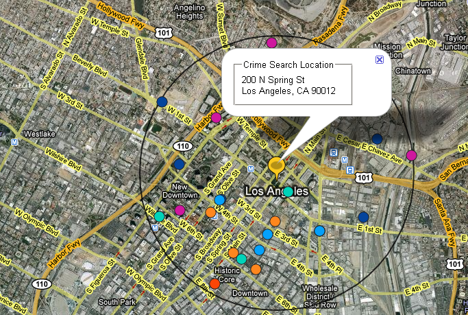
If the department's online crime map is to be believed, one might think that a downtown location just a block from the LAPD's new headquarters is the most crime-ridden place in the city. In the past six months, that location experienced 1,380 crimes--4 percent of all crimes mapped--or roughly eight a day.
The crimes were real, but the locations were off. A coding error within the system's geocoding--the process of converting addresses into map points--caused the crimes to be represented at a default location, according to a report Sunday in the Los Angeles Times. The mistake caused many crimes to be mapped miles away from their actual locations, causing false trends to be reported while masking real ones, according to the report.
The LAPD was apparently unaware of the problem until alerted to it by a Los Angeles Times reporter. Lightray Productions, the contractor that designed the site at a cost of $362,000, has promised to fix the problem, according to the report.
Besides the geocoding error, the system also faces challenges in how the streets are identified when typed into the system.
An LAPD spokeswoman told the L.A. Times that the department will work with Lightray to improve the system.
"It's not perfect," spokeswoman Mary Grady said. "We do the best we can with the software available."
The site gets 4 million to 7 million page views a month.