Digital mapping project reveals Stonehenge secrets
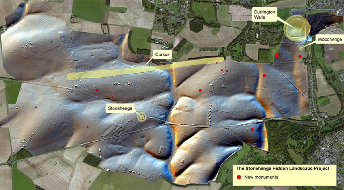
The Stonehenge site is much larger than first supposed, with a digital mapping project revealing previously unknown monuments.


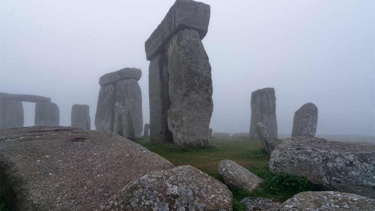
The mysterious broken circle of giant stones is not, after all, all there is to Stonehenge. The monument, which could be anywhere from 3,000 to 5,000 years old, and which consists of stones foreign to its home of Wiltshire, England, is just part of a larger site in which 17 previously unknown monuments have been discovered.
The project, called The Stonehenge Hidden Landscapes Project, conducted by the University of Birmingham and the University of Bradford in the UK, and the Ludwig Boltzmann Institute for Archaeological Prospection and Virtual Archaeology in Vienna, used a range of remote sensing technologies and geophysical surveys to find monuments and features buried underground.
"The Stonehenge Hidden Landscapes Project is unique at a global level. Not only has it revolutionised how archaeologists use new technologies to interpret the past, it has transformed how we understand Stonehenge and its landscape," said Professor Vincent Gaffney of the University of Birmingham.
The new finds include prehistoric pits, some of which seem to form astronomic alignments, homes from the Bronze and Iron Ages, dozens of burial mounds -- including one which dates to before the construction of Stonehenge that included a wooden building probably used for interring the dead following ritual exposure and the removal of flesh from the body.
Larger discoveries yield more information about known monuments, such as the Durrington Walls "super henge", a massive monument with a circumference of more than 1.5km (0.93 miles) . The survey found that, in its early days, the monument was flanked by a massive row of up to 60 posts or stones, some of which may still exist, buried in the ground surrounding the henge.
The survey used a range of non-invasive methods to search the area around Stonehenge. Remote sensing technologies such as aerial photography, laser scanning and airborne imaging spectroscopy allowed the team to observe anomalies and variations on the surface of the ground, create precise topographical models and more accurately gauge the composition of above-ground elements respectively.
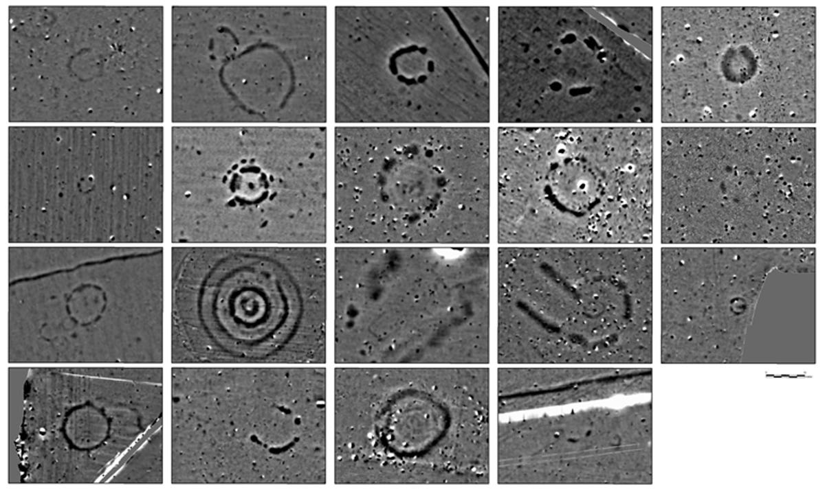
Delving under the ground, the team used magnetic prospection, which assists with mapping archaeological structures that cause anomalies in the Earth's magnetic field; ground-penetrating radar, which provides detailed, 3D information about the approximate shape, depth, and location of subterranean structures at high resolution; and electromagnetic induction, which allows the safe and non-invasive mapping of the proportions of buried objects.
"This project has revealed that the area around Stonehenge is teeming with previously unseen archaeology and that the application of new technology can transform how archaeologists and the wider public understand one of the best-studied landscapes on Earth," Professor Gaffney said.
"New monuments have been revealed, as well as new types of monument that have previously never been seen by archaeologists. All of this information has been placed within a single digital map, which will guide how Stonehenge and its landscape are studied in the future. Stonehenge may never be the same again."