Check out this Earth yearbook, as seen from space
Landsat 8 has just completed its first year in operation -- and it's already recorded some fascinating changes on Earth's surface.


- Finalist for the Nesta Tipping Point prize and a degree in broadcast journalism from the University of Missouri-Columbia.
For over four decades now, the Landsat program has been surveying the Earth's surface from space, allowing us to keep an eye on home from a distance. The advantage of so much visual data is the ability to clearly see our planet change.
The latest member of the Landsat family is Landsat 8, which was launched with help from NASA in early February 2013 and handed over to the United States Geological Survey to operate at the end of that May. Landsat 8 has a 10-year supply of fuel and is now cruising around the planet, teaming up with its older sister, Landsat 7, to provide data every eight days for any spot on the Earth's land masses, according to Jon Campbell at USGS.
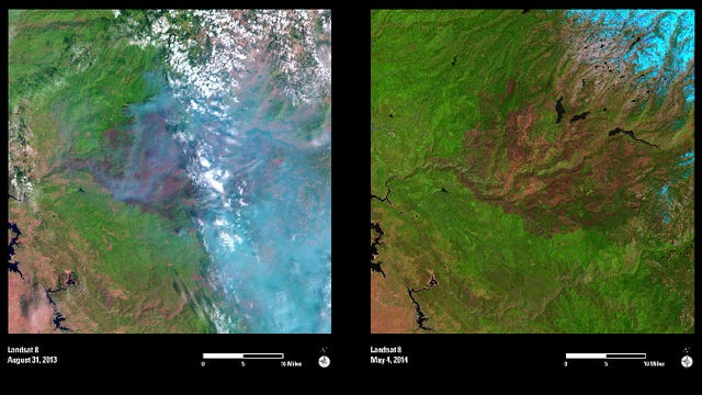
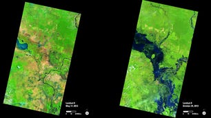
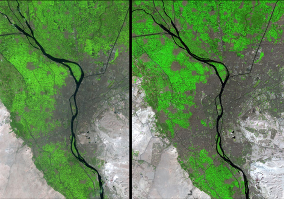
To commemorate Landsat 8's first full year of operation, the USGS has released a yearbook, highlighting 10 sets of before and after shots that show some of the changes Landsat 8 has observed in its first year, from receding glaciers to floods, fires, and sprawling cities.
Click through some of the comparisons from the yearbook in the gallery below -- and remember to smile next time you gaze up at the sky.