Big data to make driving safer
Nokia shows CNET its location-based data tracking and mapping technologies, and how its driving behavior analysis will lead to safer cars.


At an office in Berkeley, Calif., Nokia employees are watching how you drive. Using GPS data from portable navigation devices, navigation systems in cars, and smartphone apps, Nokia gathers 21 billion data points per month from drivers.
Don't worry, though, you're not so special that Nokia actually cares who you are. Each GPS data point is stripped of any identifying information, including place of origin or destination.
From Nokia's perspective, the value comes in looking at the big data picture, and figuring out how the average driver handles the road. The data goes toward Nokia's Advanced Driver Assistance System (ADAS) program, which will enable your future car to issue warnings about dangerous curves, weather events, and other road hazards.
Jane MacFarlane, head of the Nokia Here Research office, showed CNET a couple of examples of how the company is using this big location data.
Tracking traffic flow
Earlier this year, the Golden Gate Bridge unstaffed its toll booths, switching to an electronic toll system. Along with an already in place toll tag system called FasTrak, cameras at the toll gate capture car license plates, and send owners a bill for the bridge toll.
To understand how the new system affected traffic, Nokia looked at the data it had already gathered, focusing on the Golden Gate Bridge toll gate for the days leading up to the change and immediately after. What had been a bottleneck where drivers dug frantically through pockets for bills and toll takers changed $20 bills became a smooth-flowing route with only a minor slowdown.
The data collection proved the success of the new toll system, useful information for other bridge and highway authorities interested in electronic toll taking.
To help visualize this data, MacFarlane showed a video where each location-enabled device on the road, a probe in Nokia parlance, flowed over the bridge, changing color to match its speed. Using similar data for other areas, MacFarlane can spot anomalous trouble spots in cities or recurring congestion on the highways. Municipalities can use this information to plan better roadways.
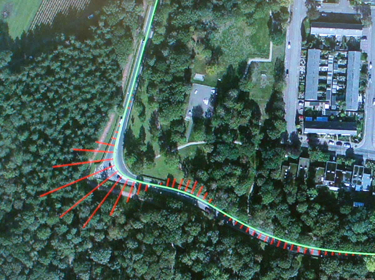
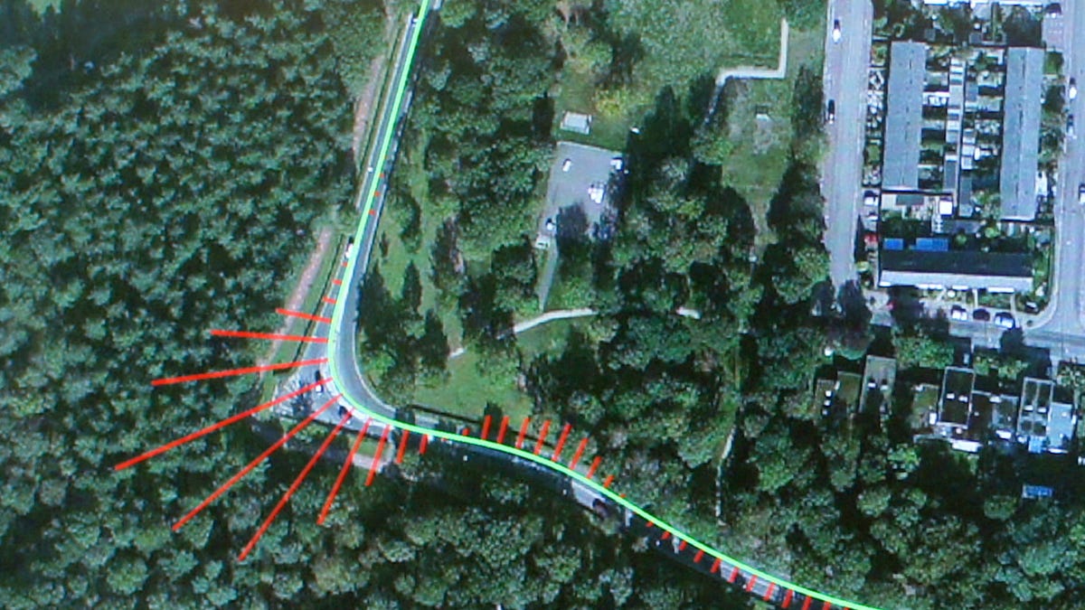
This data can also inform cars. Nokia analyzed data around the Netherlands city of Eindhoven, examining how drivers handled the roads. Focusing on a particularly sharp curve on a road near the city, MacFarlane brought up different videos visualizing how traffic moved through it. The location data showed how fast cars drove and could be interpreted to show where drivers began braking before the turn.
Further interpretation showed the lateral G-forces at which drivers took the turn, from which Nokia could come up with an average, which it considers fits a comfort zone for most drivers.
As a future concept, automakers could implement Nokia's ADAS program, incorporating similar road data, so that cars might flash an alert to the driver, showing the safe average speed for the turn. Likewise, autonomous cars could use the data to more closely simulate how humans drive, so as to provide a more comfortable and familiar experience for passengers.
Always more data
MacFarlane, who used to work at GM's OnStar division, also knows the wealth of data cars have to offer. She described Nokia's future vision of having cars send data, such as windshield wiper and headlight status, to the cloud. An analyst could see that the majority of cars in a particular area have their windshield wipers on, suggesting a local squall. Other cars could receive that information and warn drivers, who could avoid the area.
Currently, most of the Nokia Here traffic data goes to navigation systems, helping drivers avoid getting caught in traffic jams. The data is used in both Bing and Yahoo Maps, and, of course, the Nokia Here Maps app.