Apple patent filing maps out smarter mapping app
A freshly published patent application describes a more advanced mapping app that can display a variety of layers with but a touch of your fingers.


Apple's Maps app received quite a drubbing last year for its many faults and foibles. But Apple could easily overcome that bad reputation if an app envisioned in a newly published patent filing ever comes to fruition.
Published Thursday by the US Patent and Trademark Office, an Apple patent application called simply "Interactive Map" describes an electronic map that displays layers of different information and more intelligently highlights local landmarks and other spots based on your location.
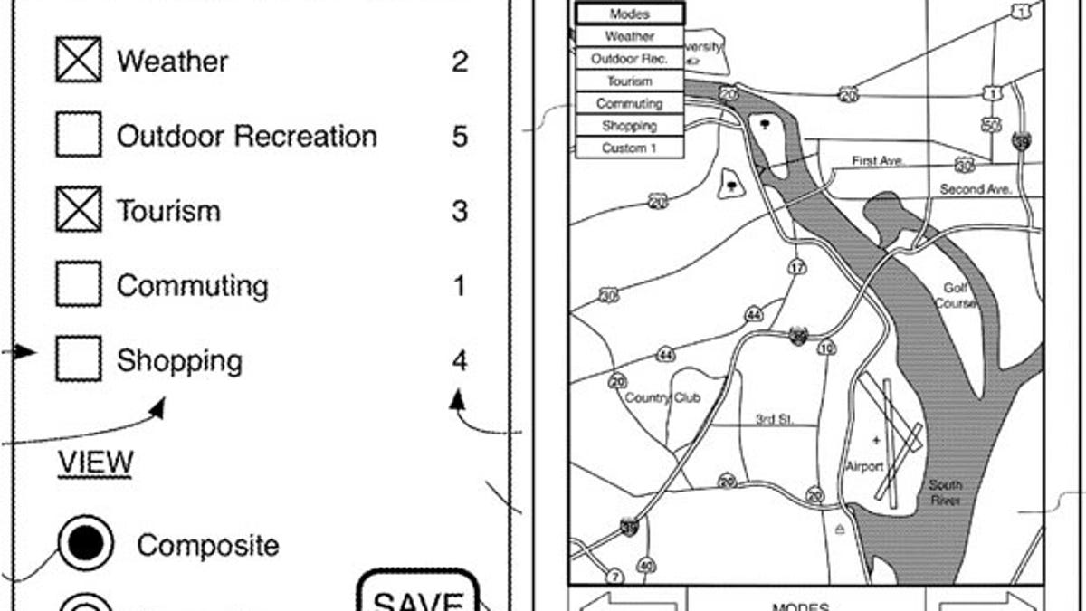
To start off, you could overlay specific types of information on the map simply by selecting certain categories. These layers would come from mapping services and from third-party sites on the Internet.
You can choose to see highways, parks, stores, airports, and weather, among other items, either separately or all together in a composite view. That by itself isn't exactly novel. But you could customize and fine-tune the views. For example, you could opt to see all roads in one single layer or keep the major highways in their own layer and smaller side streets on a different layer.
Further, you could search for items that relate only to the currently-displayed layer. Searching for food while in tourist view would display names of nearby restaurants, while the same search in parks view would present you with stores that sell food for campers.
Such a maps app would also make greater use of touch features. Tapping on a city would display such details, as demographics, hotels, and flight schedules. Tapping on a highway would show you gas stations, hotels, and restaurants along the way.
Touching two different spots on the map would calculate the distance between them and suggest at least a couple of routes between them, allowing you to choose the path you wish to travel.
Apple's patent application describes the invention in the usual technical terms:
An interactive capability enables a user to dynamically adjust the content of an electronic map. Different modes can be chosen to emphasize features relevant to a particular interest, e.g. commuting, tourism, weather, etc. Combinations of modes can be selected to create a customized map. When a search is conducted, the chosen mode functions as a filter for the retrieved results. The map responds to user input directed to a given feature, to display information relevant to that feature. Tapping or clicking on a highway displays the locations of services along the highway, Touching two points on the map causes available routes between them to be computed and displayed to the user, along with relevant data for each route. Geospatial applications can be integrated with the map to provide information pertaining to the area displayed on the map, and to refine search results to those that are relevant to the area.
Layers and other features are already available in navigation apps and Web sites. But Apple's concept would take interactive mapping several steps further. The company just needs to drive the idea past the patent stage and into the real world.
(Via AppleInsider)