A walk in the park: Google Maps hits the trails in California
Against the scenic backdrop of Northern California's Mount Tam, the search giant unveils its latest effort to stitch together a comprehensive view of the world.


MILL VALLEY, Calif. -- It's around noon on a Tuesday during a work week, and instead of being holed up in the office, I'm breathing in the fresh air at Mount Tamalpais, one of Northern California's most popular natural landmarks.
For those not as fortunate, Google hopes to give you a virtual consolation prize: the company on Tuesday released Street View footage of 14 California state parks and beaches. The project, announced at a press event here, is in partnership with California State Parks.
The newly mapped parks and beaches -- aside from Mount Tam -- include: Tomales Bay, Point Lobos, Angel Island and Marina State Beach. Using Street View, people can now take a virtual trip to the parks and beaches and trek along popular trails.
"Just because the road ends, doesn't mean there's not more beautiful imagery to be seen," Deanna Yick, program manager for Google Street View, told CNET.
Yick said the company is working with the state to identify more locations to map out, and is also looking at parks outside of California. She notes that a few of them have already gotten the Street View treatment, including New York City's Central Park.
The new views of the state parks underscore the ever-increasing granularity of Google's maps, as the company invests in technology -- from image-capturing backpacks to satellites -- that aim to stitch together a comprehensive view of the world.
Almost 10 years ago exactly, in October 2004, Google bought a small satellite imaging company called Keyhole, which kickstarted the company's mapping efforts for the decade to come. Since then, Google's mapping ambitions have exploded. There are more than one billion active monthly users of Maps services, and the company has mapped more than 5 million miles of road on Street View.
The company in 2008 began an on-the-ground campaign to get accurate local information for its maps, which uses a mix of algorithms, satellite and other imagery and other reports to keep the maps up to date. With the addition of countries including Thailand, Poland and Romania, the company last month said 50 countries were a part of the program.
Most recently, the company has also focused efforts on indoor mapping, which would be helpful for big functions like conferences and sports events. Google has also in recent months set its gaze more toward space, with the acquisition of the Skybox Imaging in June for $500 million. The startup will help Google to build and launch its own fleet of satellites, which will in part serve to improve Google's maps products, the company said.
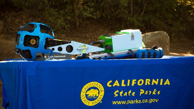
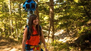
But even with those lofty space race ambitions, the company hasn't forgotten about Earth. The images of the California parks where taken using Google's Trekker, a 40-pound backpack jammed with GPS-tech and a 360-degree spinning camera. The backpack has 15 lenses and takes still photos every 2 seconds.
Since being unveiled in 2012, Google's Trekker backpacks have been used to create Street View maps of places that are inaccessible by car, such as the Galapagos Islands and Venice's famous canals.
Yick said that all of the imagery for the 14 state parks were captured by just two Trekker backpack operators over the course of two or three months.

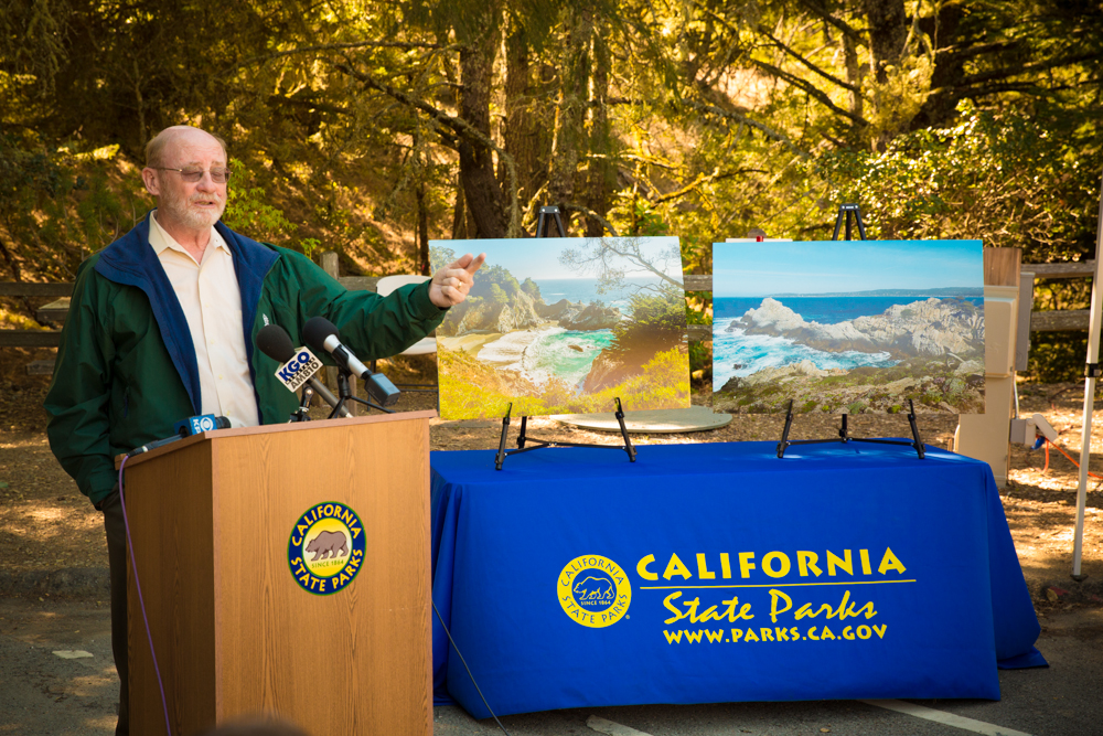
Google began its partnership with the California department in July, Yick said. The goal, state officials said, is to make the parks more accessible, and to "modernize" the state parks system.
"We live in an age that, when people go to a restaurant, they look it up first," said Lisa Mangat, acting director of California State Parks. "That's the millennial mentality."
With the Street View imagery, people can do the same when planning a trip to a park. Another more sentimental reason for looking at the footage might be trying to relive a moment virtually, if people are unable to head to the trails physically.
"But there's no substitute for experiencing it in person," said Yick.
No kidding. During the press event, a gust of wind knocked down two large photos displayed behind the dais as Yick was talking. "Well, that's nature for you," she said, laughing.