Using Windows Ink in the Maps app
Maps gets Windows Ink support in the Anniversary Update, and it's actually pretty useful.


Microsoft is totally trying to draw us all into its tablets-with-pens (aka Surface Pro 4) universe with Windows Ink...and it's totally working on me, because Windows Ink integration is cool.
I know, I know. The Windows Ink Workspace (a taskbar hub for dedicated pen-friendly apps like Sketchbook) wasn't terribly exciting when we first took a look at it, and it kind of made me think that "pen-friendly" just meant "you can draw on stuff." As it turns out, you can draw on stuff. But there's functionality beyond just doodling in Windows apps like the Maps app -- such as lines that measure distance or the ability to "draw" turn-by-turn directions.
(Windows Ink is a new feature that debuted in the Windows 10 Anniversary Update, which started rolling out to all Windows 10 users last week.)
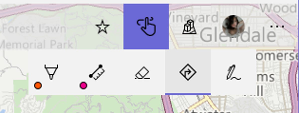
Windows Ink menu inside the Maps app.
Open up the Maps app and you'll see the Windows Ink button, which looks like a pen, in between the Favorites button (a star) and the 3D Maps button (buildings). To start using Ink, tap or click the pen icon to open the Ink menu.
There are five buttons in the Ink menu: Pen, distance, eraser, directions and touch. The pen button lets you draw freehand lines over the map. Click or tap the pen button, and you'll be able to choose your pen's color (from 30 colors) and size. You'll probably use the pen option for annotating maps -- adding arrows, circling a landmark, etc.
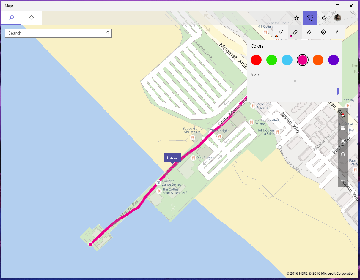
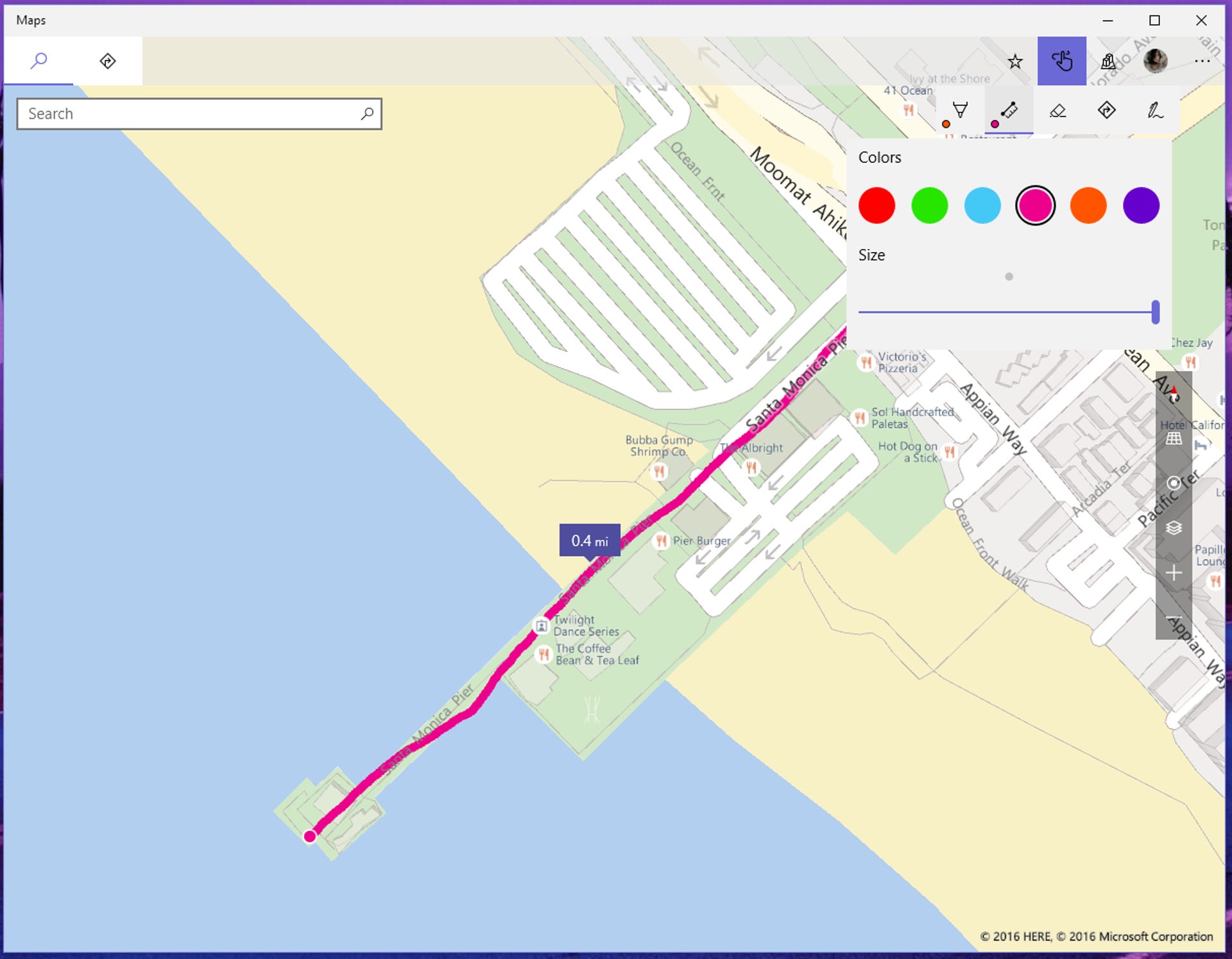
The distance tool tells you the distance of any line you draw.
The distance button lets you draw a freehand line on the map and see the distance of that line in miles or feet (depending on how long the line is). Click or tap the distance button to choose pen color (from six colors) and size. You can draw multiple distance lines on a single map. This tool might be useful if you're trying to determine the distance between two points, or if you're trying to figure out if your secret shortcut actually is shorter.
The eraser button allows you to erase any lines you've drawn on the map. To erase a line, click or tap this button and click the line to erase it completely (the eraser erases line by line). To erase all lines on a map, click or tap the eraser button and click Erase All Ink.
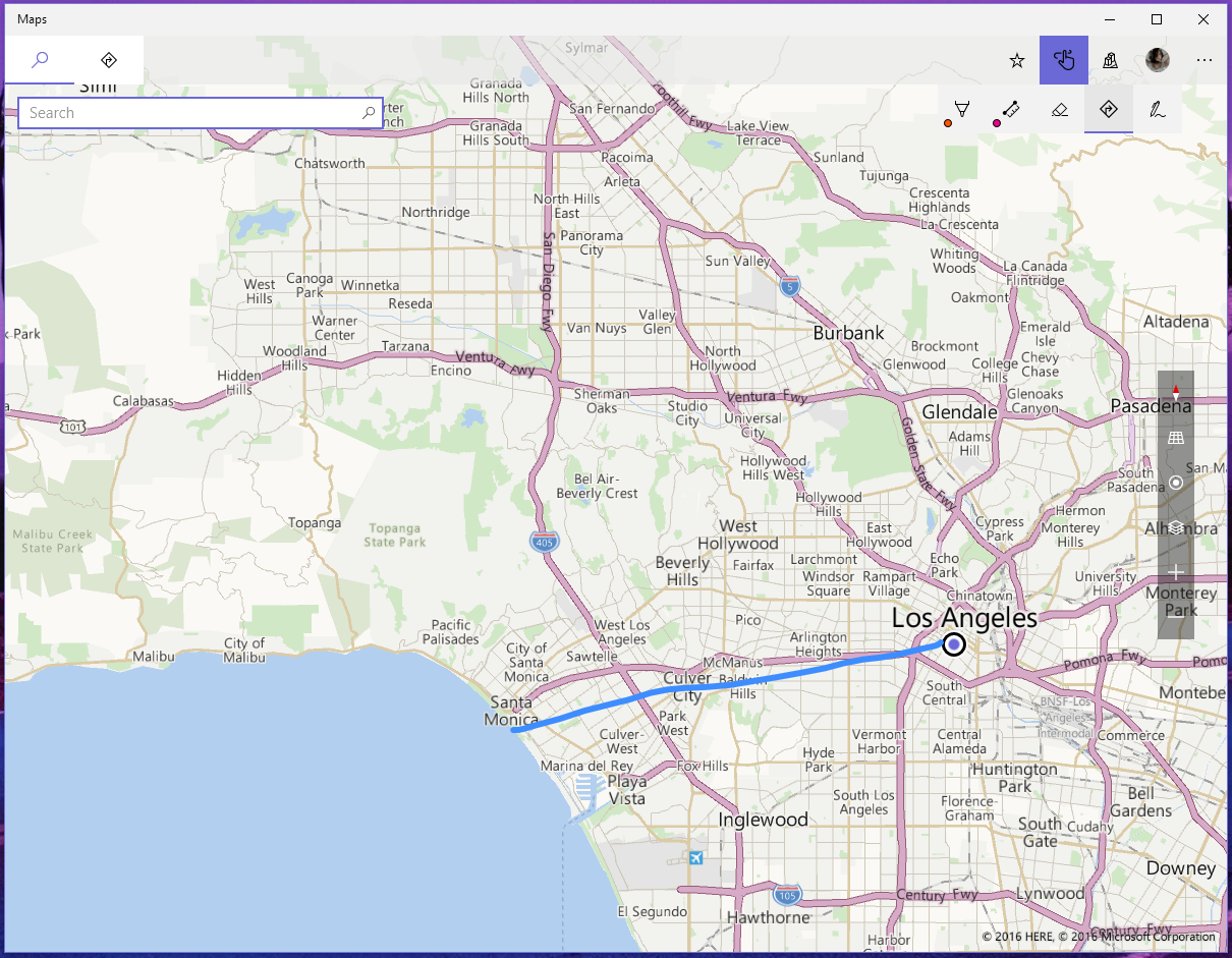
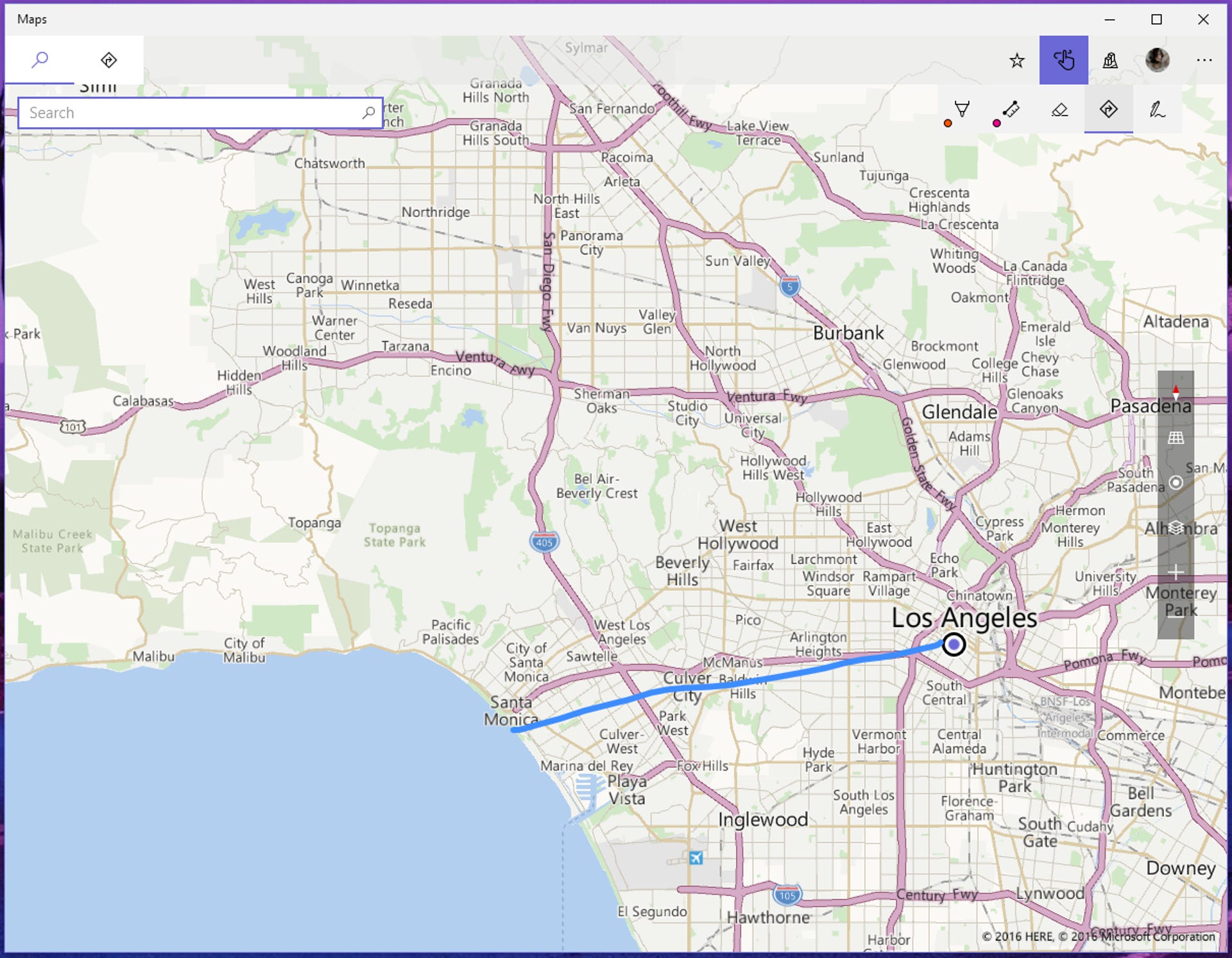
The line I drew with the directions tool.
The directions button is probably the coolest Ink feature in the Maps app: This option lets you quickly find directions between two points by drawing a line on the map. All you have to do is draw a line on a map, and the app will automatically find the best/fastest directions between those two points.
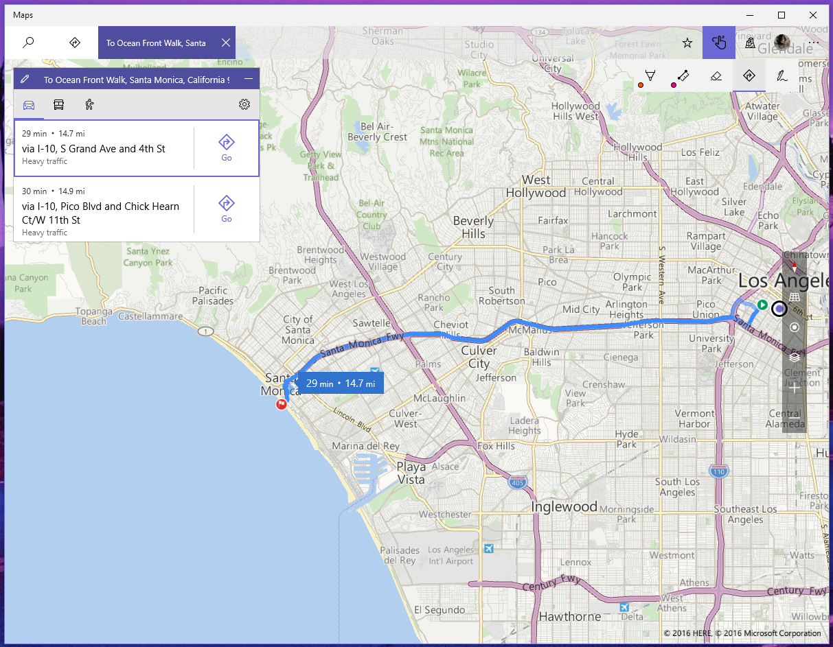
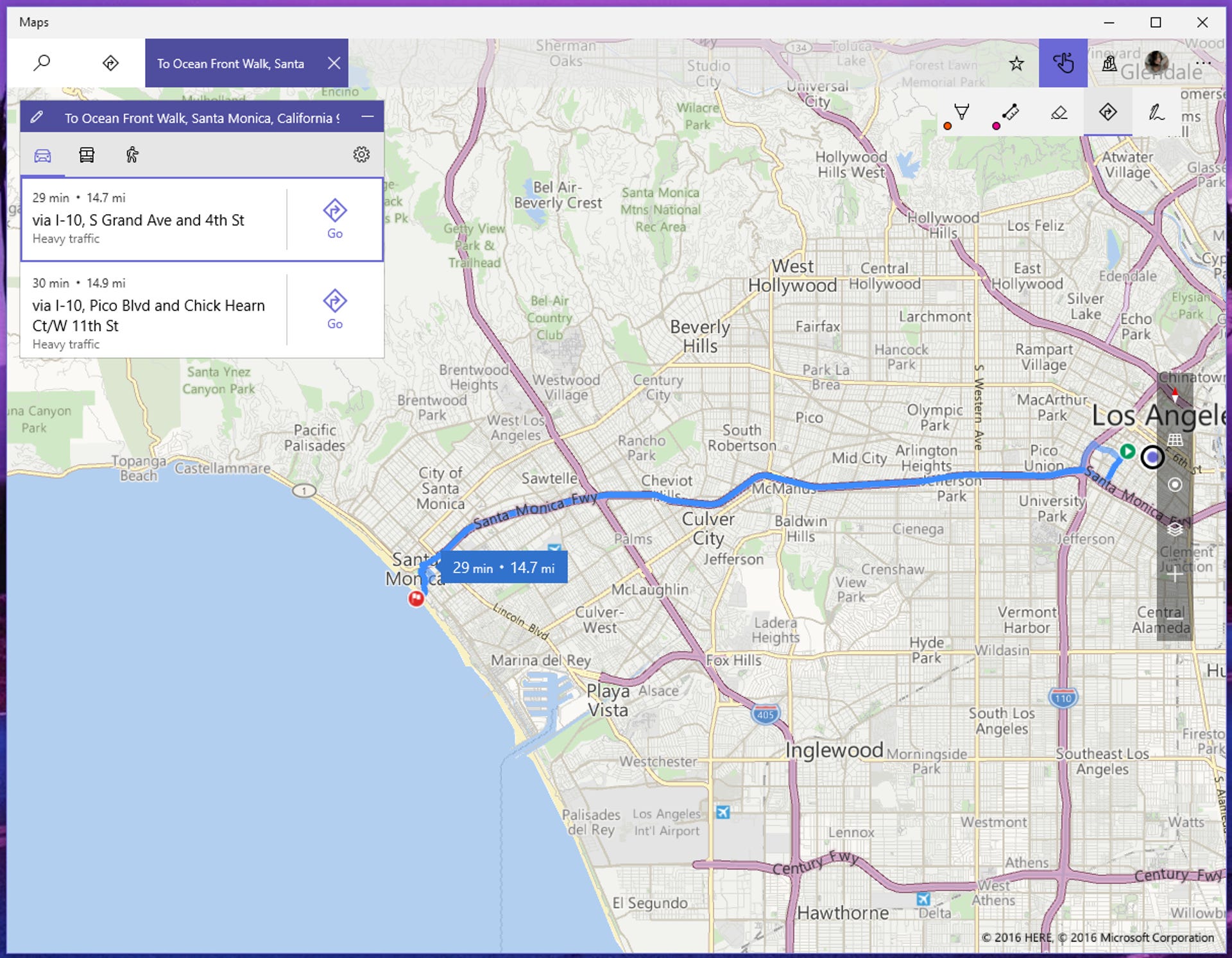
How Maps translated that line into actual directions.
Your line doesn't need to follow the road (the app will take care of that). Drawing a line with the directions tool opens up a new search/directions tab with turn-by-turn directions on the left side. You can only have one set of directions per map, but you can draw multiple lines (and open multiple map tabs).
The last button in the Ink menu, the touch button, lets you toggle between using your pen and your finger/mouse to draw on the maps. If you do not have a pen linked to your device, you will need to click this toggle to use your mouse (or finger, if you have a touchscreen) to draw on the maps.