Three apps for tracking hurricanes on Android
If you're looking for an app to monitor storms, you really can't go wrong with any of these. Each one offers something to help you prepare for storms headed your way.


Hurricane season is open, and that means keeping track of whether these storms will reach your hometown. Following the local news can be cumbersome if you're on the go, so why not use your Android device to help out? Here are three Android apps that can keep you informed on severe weather conditions.
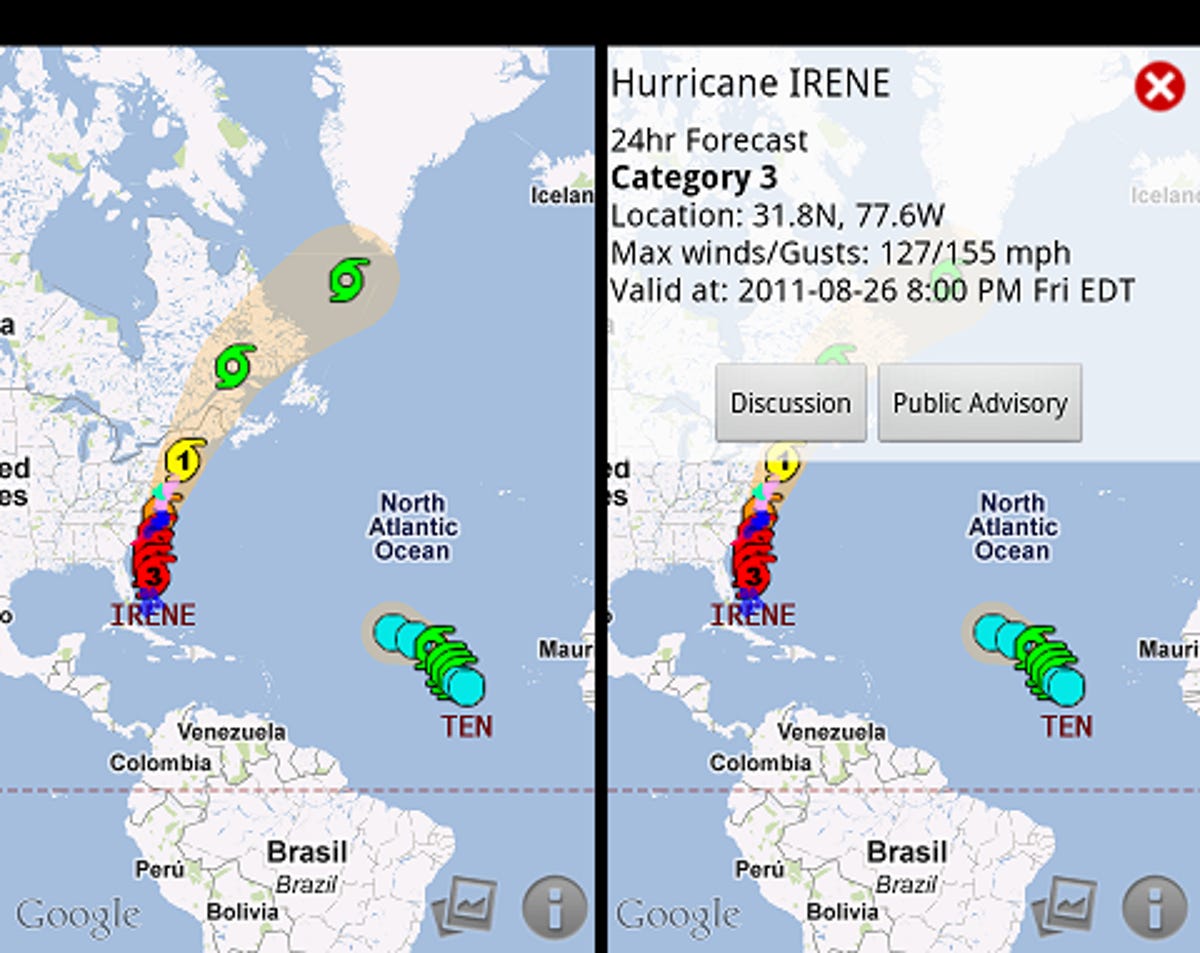
Hurricane Hound
Hurricane Hound is an app designed specifically for tracking storms. Each storm is labeled by name with several icons denoting the path the hurricane is predicted to take. These icons are colored and labeled based on the category rating the storm will be at each location. Storm warnings are also illustrated on the map in the form of colored lines. Finally, the potentially affected area of the storm is noted by a yellow coloring of the map, displaying the other possible trajectories for the storm.
This app is great for the purpose it was designed for; storm directions and strengths are clearly labeled, and it's very easy to pick up the app and understand what it's showing you. Even though you can't see where storms have previously traveled, you can easily pinpoint the current location because there is no old data on the map to obscure it.
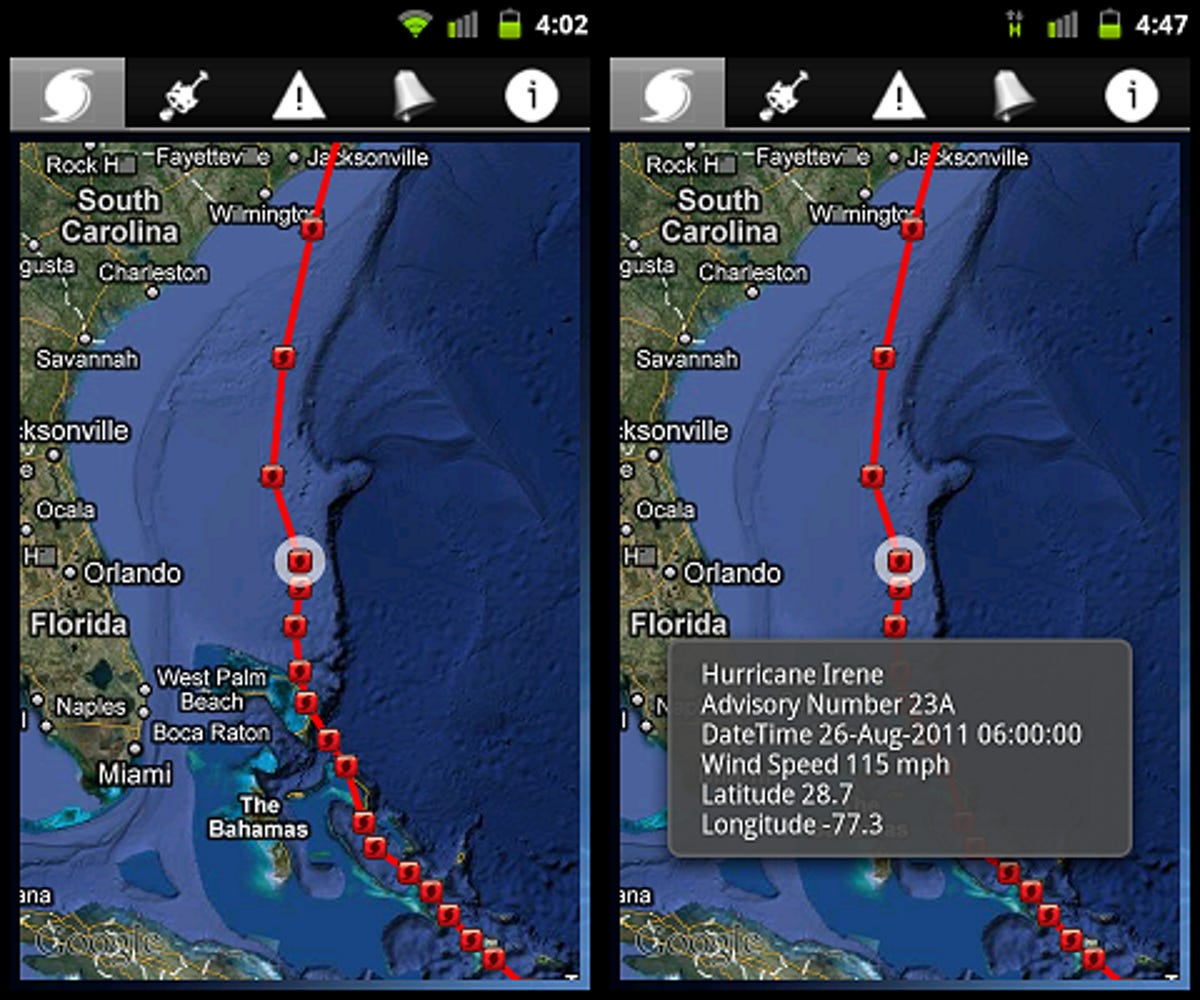
HurricaneSoftware
This app is very similar to Hurricane Hound in appearance and features. A notable difference is the inclusion of recorded (as opposed to predicted) readings from previous locations. The storm's current location is indicated by a white circle around the icon, which is colored in a similar fashion to Hurricane Hound.
Instead of the yellow-colored trajectory area on the map, this app uses a connect-the-dots-style path for storms. While this won't show the exact path of a hurricane, it can give you a good idea (and as history has shown, storms can decide to go a completely different direction anyway). Also, the names of storms are hidden until you tap on one of the dots in a trajectory. This can be helpful if a lot of smaller storms are grouped in one area, keeping the map free of clutter.
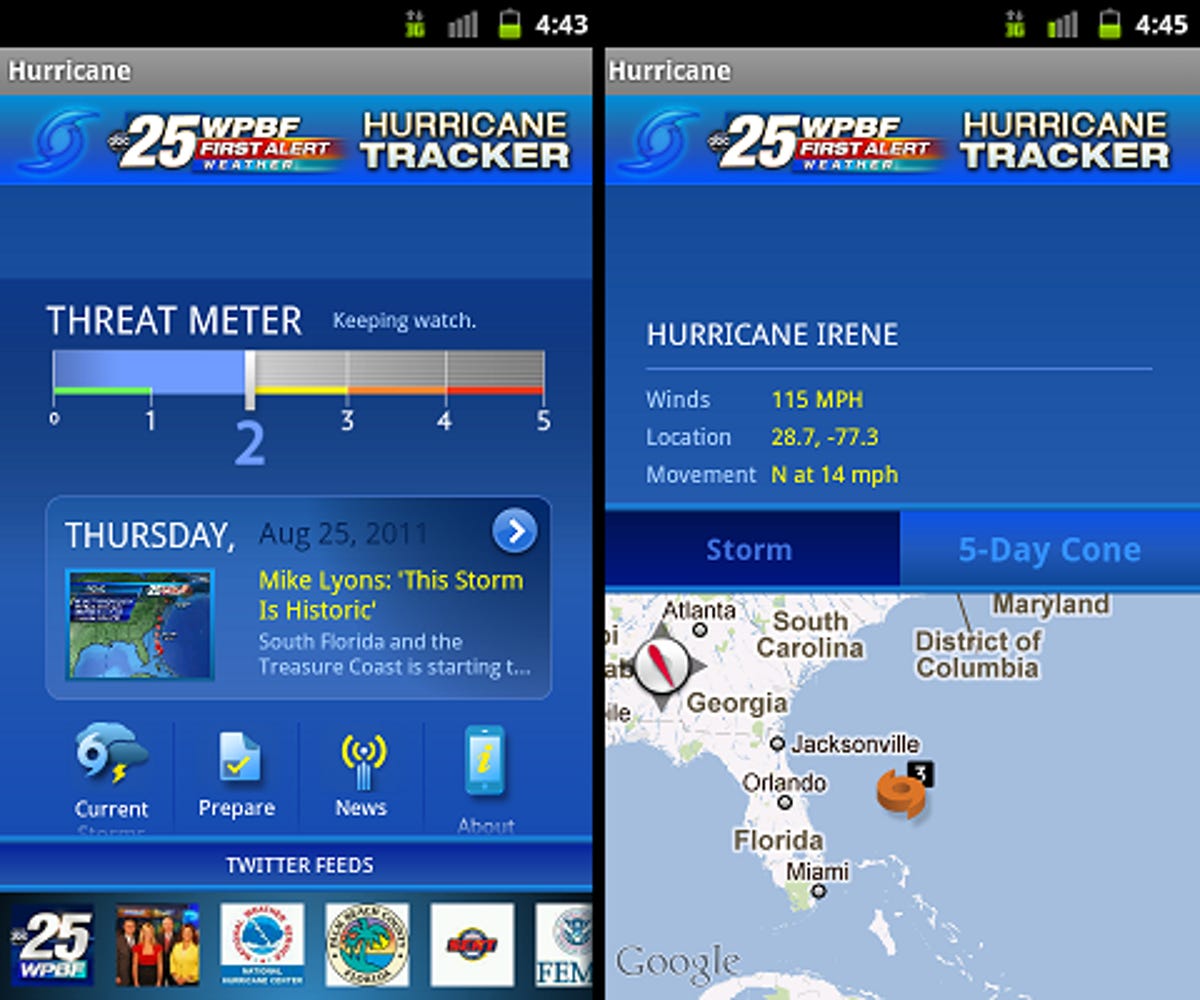
WPBF Hurricane
Though the phone numbers and shelter locations provided within this app are specific to Florida areas, the other tools can work for people living anywhere. There is also a sister app for the Louisiana area.
Aside from monitoring tools, this app also provides links to news stories and a hurricane checklist to help prepare for the oncoming severe weather. The map in WPBF displays the current location of storms, colored by category rating and your location, but it omits the storm's trajectory. Instead, a threat meter is provided on the main page, which is similar to the usefulness of a visual path. Reading this meter tells you the likelihood of your area being hit by a storm on a scale of 0 to 5, with 0 being no danger and 5 being an almost 100 percent guaranteed hit.
This app is an invaluable tool for planning ahead. Having checklists available for preparing your home, family, and pets for hurricanes can be a literal lifesaver--both for veterans of hurricane territory and those new to the region. Also, the inclusion of an easy-to-find and constantly updated newsfeed on storms is a huge plus.
If you're looking for an Android app to monitor storms, you really can't go wrong with any of these. Despite being similar, each app has at least one feature that makes it worth grabbing if you're serious about getting prepared for any storms headed your way.